
IMAGES TAKEN NEAR TO
Orchard Street, WORCESTER, WR5 3DY
Introduction
This page details the photographs taken nearby to Orchard Street, WR5 3DY by members of the Geograph project.
The Geograph project started in 2005 with the aim of publishing, organising and preserving representative images for every square kilometre of Great Britain, Ireland and the Isle of Man.

There are currently over 7.5m images from over14,400 individuals and you can help contribute to the project by visiting https://www.geograph.org.uk
Image Map
Images are licensed for reuse under creativecommons.org/licenses/by-sa/2.0
Notes
- Clicking on the map will re-center to the selected point.
- The higher the marker number, the further away the image location is from the centre of the postcode.
Image Listing (48 Images Found)
Images are licensed for reuse under creativecommons.org/licenses/by-sa/2.0
Image
Details
Distance
1
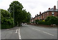
Site of new roundabout on the Bath road
Looking south down the Bath road from the site of the new roundabout to bring in the road to feed the Diglis development site.
Image: © Andrew Darge
Taken: 21 Jun 2006
0.02 miles
2
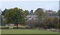
Battenhall ridge
Housing development above the Duck Brook valley which is liable to flash flooding and has for sometime been used for sports fields and dog walking . The big house on the hill is St.Mary's school for girls .
Image: © Andrew Darge
Taken: 30 Oct 2011
0.03 miles
3
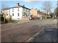
Bath Road, Worcester
View northwards along Bath Road, the light painted building on the left is the former Berwick Arms which closed a while ago. Half of this building was demolished, the vacant land this has created is now being built on. The road is the A38, approaching Worcester from the south.
Image: © Philip Halling
Taken: 5 Mar 2016
0.03 miles
4
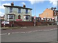
The former Berwick Arms, Bath Road
The former Berwick Arms was public house from 1900 to 2008. Originally this building was double what it is there now, the part on the right which was demolished a couple of years ago was only single storey. Building work has now begun on the right, building what appears at this stage to be three properties.
Image: © Philip Halling
Taken: 5 Mar 2016
0.03 miles
5
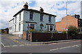
Former Berwick Arms
The building on Bath Road in Worcester used to be the Berwick Arms but has now been closed for sometime. It used to be twice the width but half of it has been demolished, hence to space to the right.
Image: © Philip Halling
Taken: 22 Aug 2014
0.04 miles
6
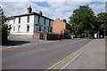
Bath Road, Worcester
Bath Road passing the former public house, the Berwick Arms.
Image: © Philip Halling
Taken: 22 Aug 2014
0.04 miles
7
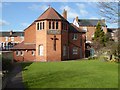
St Mark's church
St Mark's church on Bath Road in Worcester.
Image: © Philip Halling
Taken: 5 Mar 2016
0.06 miles
8
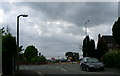
Demolition complete
The new view and site for a roundabout is revealed
Image: © Andrew Darge
Taken: 21 Jun 2006
0.07 miles
9
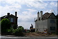
Demolition begins for the new road to Diglis
The first tangible sign of the developments at Diglis on the Bath road out of Worcester.
Image: © Andrew Darge
Taken: 15 Jun 2006
0.07 miles
10
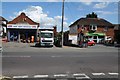
Businesses on Bath Road
A Coop supermarket and a tool hire business on Bath Road in Worcester.
Image: © Philip Halling
Taken: 22 Aug 2014
0.07 miles