
IMAGES TAKEN NEAR TO
Ramillies Drive, WORCESTER, WR5 2QD
Introduction
This page details the photographs taken nearby to Ramillies Drive, WR5 2QD by members of the Geograph project.
The Geograph project started in 2005 with the aim of publishing, organising and preserving representative images for every square kilometre of Great Britain, Ireland and the Isle of Man.

There are currently over 7.5m images from over14,400 individuals and you can help contribute to the project by visiting https://www.geograph.org.uk
Image Map
Images are licensed for reuse under creativecommons.org/licenses/by-sa/2.0
Notes
- Clicking on the map will re-center to the selected point.
- The higher the marker number, the further away the image location is from the centre of the postcode.
Image Listing (55 Images Found)
Images are licensed for reuse under creativecommons.org/licenses/by-sa/2.0
Image
Details
Distance
1
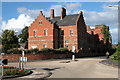
Norton Barracks, Worcester
Norton Barracks was completed in 1877 and accommodated the Worcestershire Regiment. After its closure it has been converted into residential accommodation and the land surrounding it built on. For more information see: http://www.worcestershireregiment.com/wr.php?main=inc/norton_barracks
Image: © Philip Halling
Taken: 25 Aug 2005
0.03 miles
2
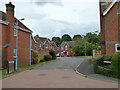
Ramillies Drive, Norton, Worcestershire
Ramillies was a battle in the War of the Spanish Succession and also the name of several Royal Naval vessels. The streets names here have military connections.
Image: © Chris Allen
Taken: 9 Aug 2021
0.04 miles
3
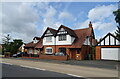
Houses on Crookbarrow Road, Brockhill Village
Image: © JThomas
Taken: 13 Aug 2021
0.04 miles
4
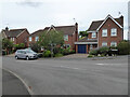
Mandalay Drive, Norton, Worcestershire
Some of the newer housing stock.
Image: © Chris Allen
Taken: 9 Aug 2021
0.05 miles
5
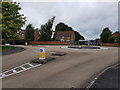
Roundabout of battle roads, Brockhill Village
The new 'village' built of the site of the old Worcestershire Regiment barracks have names of famous battles the regiment was involved in. This shows Talavera Road with Salamanca Drive opposite.
Image: © Jeff Gogarty
Taken: 9 Jul 2020
0.05 miles
6
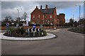
Norton Barracks and Crookbarrow Road
Much of the land around Norton Barracks which closed in 1962 has been built on with residential housing.
Image: © Philip Halling
Taken: 21 Feb 2015
0.06 miles
7
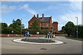
Roundabout on Crookbarrow Road, Brockhill Village
Towards Norton Barracks.
Image: © JThomas
Taken: 13 Aug 2021
0.06 miles
9
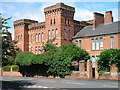
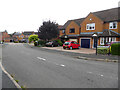
Norton Barracks - now converted to apartments
Taken a few years after the old Worcester Regiment barracks were converted to apartments. This is the only substantial building that remains from the army days. The surrounding buildings were generally simple single storey accommodation blocks.
Image: © Peter Morgan
Taken: 12 Jul 2009
0.07 miles
10
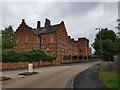
Norton Barracks (1)
Formerly home of the Worcestershire Regiment and now apartments. The style is Fortress Gothic Revival and they were built between 1874 and 1877.
Image: © Jeff Gogarty
Taken: 9 Jul 2020
0.08 miles