IMAGES TAKEN NEAR TO
Spetchley Road, WORCESTER, WR5 2NL
Introduction
This page details the photographs taken nearby to Spetchley Road, WR5 2NL by members of the Geograph project.
The Geograph project started in 2005 with the aim of publishing, organising and preserving representative images for every square kilometre of Great Britain, Ireland and the Isle of Man.

There are currently over 7.5m images from over14,400 individuals and you can help contribute to the project by visiting https://www.geograph.org.uk
Image Map
Images are licensed for reuse under creativecommons.org/licenses/by-sa/2.0
Notes
- Clicking on the map will re-center to the selected point.
- The higher the marker number, the further away the image location is from the centre of the postcode.
Image Listing (86 Images Found)
Images are licensed for reuse under creativecommons.org/licenses/by-sa/2.0
Image
Details
Distance
1
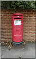
Elizabeth II postbox on Spetchley Road, Worcester
Postbox No. WR5 50.
Image: © JThomas
Taken: 12 Aug 2021
0.03 miles
2
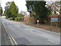
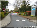
Nunnery Wood High School access road
The school is barely visible at the end of the access road. There are quite a few schools and colleges in this corner of Worcester with a primary school, a high school and a sixth form college.
Image: © Chris Allen
Taken: 26 Mar 2017
0.04 miles
4
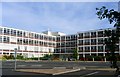
Worcester Sixth Form College
Built in the 60's as the Girls grammar for the area it now provides up to the minute education for both sixth formers and adults seeking A levels and other entry qualifications for university and other higher education.
Image: © Andrew Darge
Taken: 20 Jun 2006
0.06 miles
5
Entrance to Worcester Sixth Form College
Unfortunately the large buildings are very well hidden and all the no public access signs served to discourage me from poking any further.
I had a run in with a caretaker in Redditch who objected to me photographing his school's rather industrial chimney.
Image: © Chris Allen
Taken: 26 Mar 2017
0.08 miles
6
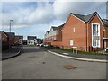
Beltex Drive, Weogoran Park, Worcester
A new housing development. The roads have still to be finished as evidenced by the raised inronworks.
Image: © Chris Allen
Taken: 15 Mar 2021
0.08 miles
7
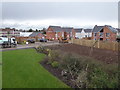
Weogoran Park, Worcester
A new housing development being built on the site of former government offices.
Image: © Chris Allen
Taken: 27 Jan 2020
0.10 miles
8
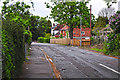
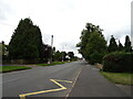
Worcester : Nunnery Lane
Nunnery Lane heading through the residential areas of Worcester.
Image: © Lewis Clarke
Taken: 5 May 2014
0.11 miles
9
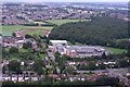
Worcester Sixth Form College
From a hot air balloon at about 700ft
Image: © Andrew Darge
Taken: 17 Aug 2007
0.12 miles
10
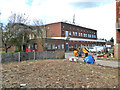
Telephone exchange, London Road, Worcester
Image: © Chris Allen
Taken: 15 Mar 2021
0.12 miles