
IMAGES TAKEN NEAR TO
Hailsham Close, WORCESTER, WR5 2JB
Introduction
This page details the photographs taken nearby to Hailsham Close, WR5 2JB by members of the Geograph project.
The Geograph project started in 2005 with the aim of publishing, organising and preserving representative images for every square kilometre of Great Britain, Ireland and the Isle of Man.

There are currently over 7.5m images from over14,400 individuals and you can help contribute to the project by visiting https://www.geograph.org.uk
Image Map
Images are licensed for reuse under creativecommons.org/licenses/by-sa/2.0
Notes
- Clicking on the map will re-center to the selected point.
- The higher the marker number, the further away the image location is from the centre of the postcode.
Image Listing (46 Images Found)
Images are licensed for reuse under creativecommons.org/licenses/by-sa/2.0
Image
Details
Distance
1
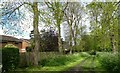
Tree lined avenue
This path is between the housing and the woodland and allotments in Battenhall , I suspect that it once was the drive to a big house.
Image: © Andrew Darge
Taken: 8 May 2012
0.05 miles
2
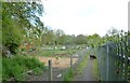
Allotment gardens in Battenhall
A little gem of an allotment site between the railway and fairly modern housing in Battenhall.
Image: © Andrew Darge
Taken: 8 May 2012
0.06 miles
3
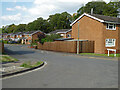
Arundel Drive, Worcester
From Battenhall Avenue
Image: © Chris Allen
Taken: 4 Sep 2021
0.07 miles
4
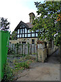
Gardener's Cottage, Battenhall Mount, Worcester
A Grade II Listed building. Built c1895 to the design of John Henry williams as part of the Battenhall Mount complex. This was later used as a catholic school unitl closure in 2014 and this building was used as staff accommodation. The site is now being converted to retirement housing.
Image: © Chris Allen
Taken: 4 Sep 2021
0.08 miles
5
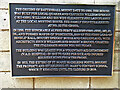
Battenhall Mount retirement village, Worcester
A plaque on this Grade II* Listed building explaining its history.
Image: © Chris Allen
Taken: 4 Sep 2021
0.11 miles
6
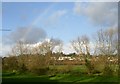
Battenhall ridge
This run of housing occupies the base of a slight ridge above the flood plain of the duck brook . St Mary's convent school is in the big house on the hill.
Image: © Andrew Darge
Taken: 23 Nov 2008
0.12 miles
7
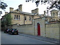
Battenhall Mount retirement village, Worcester
Former St Mary's Convent School. A former private house that was then a school and is now part of a retirement village. It is listed Grade II*.
Image: © Chris Allen
Taken: 4 Sep 2021
0.13 miles
8
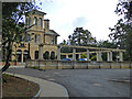
Battenhall Mount retirement village, Worcester
Former St Mary's Convent School. A former private house that was then a school and is now part of a retirement village. It is listed Grade II*.
Image: © Chris Allen
Taken: 4 Sep 2021
0.13 miles
9
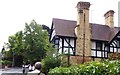
Empty Convent
It is to be hoped that redevelopment of this site retains at least some of this splendid Victorian building .
Image: © Andrew Darge
Taken: 24 Aug 2018
0.13 miles
10
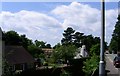
A new building for Redhill School
The pupils at Redhill School are currently in temporary classrooms at the end of the fields (out of sight to the left) while a striking new building goes up on the site of the old school, now demolished but seemingly built after the 1940's submission location map.
Image: © Andrew Darge
Taken: 15 Jun 2006
0.16 miles