
IMAGES TAKEN NEAR TO
Whittington Road, WORCESTER, WR5 2GA
Introduction
This page details the photographs taken nearby to Whittington Road, WR5 2GA by members of the Geograph project.
The Geograph project started in 2005 with the aim of publishing, organising and preserving representative images for every square kilometre of Great Britain, Ireland and the Isle of Man.

There are currently over 7.5m images from over14,400 individuals and you can help contribute to the project by visiting https://www.geograph.org.uk
Image Map
Images are licensed for reuse under creativecommons.org/licenses/by-sa/2.0
Notes
- Clicking on the map will re-center to the selected point.
- The higher the marker number, the further away the image location is from the centre of the postcode.
Image Listing (69 Images Found)
Images are licensed for reuse under creativecommons.org/licenses/by-sa/2.0
Image
Details
Distance
1
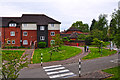
Worcester : New College
Looking towards the buildings of New College which is an educational facility for the blind.
Image: © Lewis Clarke
Taken: 5 May 2014
0.02 miles
2
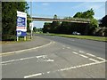
Whittington Road
Whittington Road viewed from the entrance to the former government buildings which were tax offices and used by DEFRA. The site was acquired by St Modwen and is currently available to let.
Image: © Philip Halling
Taken: 2 Jun 2016
0.02 miles
3
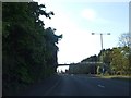
Footbridge outside Worcester College for the Blind
Providing a safe crossing for students at the college across the dual carriageway. The college buildings are on the left of the road.
Image: © David Smith
Taken: 19 May 2013
0.03 miles
4
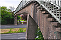
Worcester : Whittington Road Footbridge
A footbridge helping people to cross Whittington Road safely.
Image: © Lewis Clarke
Taken: 5 May 2014
0.04 miles
5
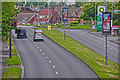
Worcester : Whittington Road A44
From a footbridge looking down towards the road as it heads into Worcester.
Image: © Lewis Clarke
Taken: 5 May 2014
0.04 miles
6

Towards footbridge on Whittington Road
This is the A44, the route out of Worcester and the approach towards the M5.
Image: © Clint Mann
Taken: 18 Jul 2016
0.04 miles
7
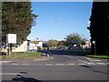
DEFRA Offices, Whittington Road Worcester
Department for the Environment, Food and Rural Affairs now occupy these "Government Offices" based on the old "temporary" war time single story spurred buildings.
Image: © Bob Embleton
Taken: 9 Nov 2005
0.05 miles
8
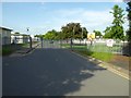
Entrance to former Government buildings
These government offices on Whittington Road in Worcester used to be the site of the tax office and DEFRA (Department of Environment, Food and Rural Affairs), formerly MAFF (Ministry of Agriculture, Fisheries and Food). This 19 acre site has been sold to St Modwen for redevelopment. Currently the site is to let.
Image: © Philip Halling
Taken: 2 Jun 2016
0.06 miles
9
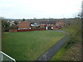
Whitewood Close, Worcester
Photographed from the foot bridge near the Blind College. I believe this is probably part of Redhill. One of the many 'ordinary' views that go to make up Geograph.
Image: © Chris Allen
Taken: 12 Feb 2012
0.06 miles
10
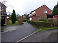
The end of Whitewood Way, Worcester
In the background is the footbridge over the A44 London Road.
Image: © Chris Allen
Taken: 27 Jan 2020
0.07 miles