
IMAGES TAKEN NEAR TO
London Road, WORCESTER, WR5 2EJ
Introduction
This page details the photographs taken nearby to London Road, WR5 2EJ by members of the Geograph project.
The Geograph project started in 2005 with the aim of publishing, organising and preserving representative images for every square kilometre of Great Britain, Ireland and the Isle of Man.

There are currently over 7.5m images from over14,400 individuals and you can help contribute to the project by visiting https://www.geograph.org.uk
Image Map
Images are licensed for reuse under creativecommons.org/licenses/by-sa/2.0
Notes
- Clicking on the map will re-center to the selected point.
- The higher the marker number, the further away the image location is from the centre of the postcode.
Image Listing (91 Images Found)
Images are licensed for reuse under creativecommons.org/licenses/by-sa/2.0
Image
Details
Distance
1
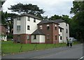
On London Road
New flats at the junction of Worcester's London Road and Wych Elm Close. The Explorer map confirms the location just inside this square.
Image: © Mary and Angus Hogg
Taken: 29 Sep 2008
0.01 miles
3
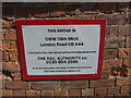
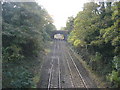
Railway bridge details, Worcester
The sign informs us that the bridge is on the Oxford, Worcester and Wolverhampton Railway (OWW - also referred to as the Old Worse and Worse). It is 119 miles and 56 chains (presumably) from London Paddington on the A44 London Road and it is an over bridge (OB). Network Rail and cricket club groundsmen must be the only people referring to chains in the 21st century.
I am not complaining, I was brought up at the intersection of imperial and metric/pounds, shillings and pence and decimal. It amuses me when watching quiz shows when people struggle with imperial measures, my generation is 'bilingual'.
Image: © Chris Allen
Taken: 24 Apr 2021
0.04 miles
4
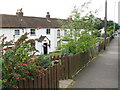
Hidden cottages
This row of terraced cottages is tucked away at a lower level than the A44's carriageway, in the vee between the road and the Worcester-Pershore railway.
Image: © Peter Whatley
Taken: 25 Jun 2008
0.04 miles
6
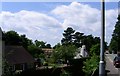
A new building for Redhill School
The pupils at Redhill School are currently in temporary classrooms at the end of the fields (out of sight to the left) while a striking new building goes up on the site of the old school, now demolished but seemingly built after the 1940's submission location map.
Image: © Andrew Darge
Taken: 15 Jun 2006
0.05 miles
7
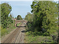
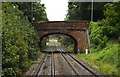
The Oxford, Worcester and Wolverhampton Railway from London Road
Looking towards Lark Hill Road bridge and Shrub Hill Station (the latter is not visible).
Image: © Chris Allen
Taken: 24 Apr 2021
0.06 miles
8
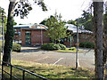
Red Hill C of E Primary School, Worcester
Seen from the pedestrian entrance on London Road.
Image: © Chris Allen
Taken: 4 Sep 2021
0.07 miles
9
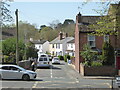
Foxwell Street seen across the A44 London Road
Image: © Chris Allen
Taken: 24 Apr 2021
0.07 miles
10
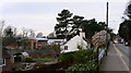
New School complete
I bet the pupils and teachers will be more than glad to swap temporary classrooms for this splendid building.
Image: © Andrew Darge
Taken: 11 Mar 2007
0.07 miles