
IMAGES TAKEN NEAR TO
London Road, WORCESTER, WR5 2DL
Introduction
This page details the photographs taken nearby to London Road, WR5 2DL by members of the Geograph project.
The Geograph project started in 2005 with the aim of publishing, organising and preserving representative images for every square kilometre of Great Britain, Ireland and the Isle of Man.

There are currently over 7.5m images from over14,400 individuals and you can help contribute to the project by visiting https://www.geograph.org.uk
Image Map
Images are licensed for reuse under creativecommons.org/licenses/by-sa/2.0
Notes
- Clicking on the map will re-center to the selected point.
- The higher the marker number, the further away the image location is from the centre of the postcode.
Image Listing (626 Images Found)
Images are licensed for reuse under creativecommons.org/licenses/by-sa/2.0
Image
Details
Distance
1
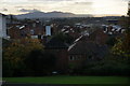
Rooftops in Worcester
Sunset is fast approaching in Fort Royal Park, with the Malvern Hills in distance profile.
Image: © Bill Boaden
Taken: 2 Nov 2014
0.01 miles
2
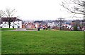
Fort Royal Park, Worcester
Fort Royal Park is a small but pleasant public park, mainly on the top of a hill, which is fairly near the centre of Worcester. It is probably one of the lesser known of the city's open spaces, and currently it is not particularly well signposted. It has some nice walks, trees, seats and flower beds, as well as a play area for children. Perhaps its best feature is that its height gives it some excellent views across Worcester and particularly to the Cathedral. It was the site of a Royalist fort in the Civil War of the mid-17th century, but there is very little to see from that time. Worcester was sympathetic to the Royalist cause but the Battle of Worcester, on the 3rd September 1651, the last of the Civil War, was lost by the Royalists.
Image: © P L Chadwick
Taken: 10 Mar 2012
0.04 miles
3
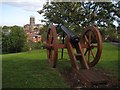
Cannon on Fort Royal Hill
This replica cannon on Worcester's Fort Royal Hill commemorates the Battle of Worcester on 3 September 1651. Fort Royal Hill was a Royalist stronghold which was overrun by the Parliamentarian forces who then turned the captured cannons on the city, defeating the royalist forces and bringing to an end the English Civil War. Worcester Cathedral is in the background.
Image: © Philip Halling
Taken: 28 Aug 2015
0.04 miles
4
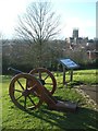
Defending the 'Faithful City'
During the Civil War artillery placed in a sconce at Fort Royal protected the city walls below from the besieging forces. The position was over-run on 3rd September 1651 during the Battle of Worcester by the Parliamentary forces' Essex militia with the Royalist Army routed.
King Charles II watched the progress of the battle raging on both sides of the river from the cathedral tower eventually fleeing along a route commemorated by the Monarch's Way footpath to Shoreham and exile in France.
Image: © John M
Taken: 5 Mar 2016
0.04 miles
5
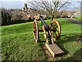
Cannon in Fort Royal Park
Replica cannon in the park on Fort Royal Hill with Worcester Cathedral in its sight.
Image: © Philip Halling
Taken: 25 Jan 2019
0.04 miles
6
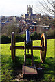
Fort Royal Park, Worcester
One of several replica cannons that commemorate the Battle of Worcester, fought here in 1651, seems to have the cathedral in its sights.
Image: © Stephen McKay
Taken: 5 Mar 2016
0.04 miles
7

Silhouetted cannon and trees
Silhouetted cannon and trees against the rising sun on Fort Royal Hill in Worcester. The replicate cannon commemorates the Battle of Worcester in September 1651.
Image: © Philip Halling
Taken: 12 Feb 2016
0.05 miles
8
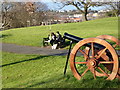
Fort Royal Park - replica cannon
The site of a civil war skirmish around a redoubt sited on the hill. Seen on the occasion of Geograph's eleventh birthday meet in Worcester.
Image: © Chris Allen
Taken: 5 Mar 2016
0.05 miles
9
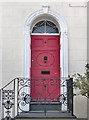
Detail of 4 Green Hill, Worcester
A flight of steps leads to an early C19th doorcase with reeded surrounds. The railings are cast or wrought iron.
Image: © Stephen Richards
Taken: 17 Jul 2014
0.05 miles
10
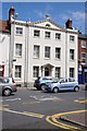
Georgian House at Sidbury
A substantial Georgian town house on London Road in Sidbury, Worcester.
Image: © Philip Halling
Taken: 22 Aug 2014
0.05 miles