
IMAGES TAKEN NEAR TO
Battenhall Road, WORCESTER, WR5 2BH
Introduction
This page details the photographs taken nearby to Battenhall Road, WR5 2BH by members of the Geograph project.
The Geograph project started in 2005 with the aim of publishing, organising and preserving representative images for every square kilometre of Great Britain, Ireland and the Isle of Man.

There are currently over 7.5m images from over14,400 individuals and you can help contribute to the project by visiting https://www.geograph.org.uk
Image Map
Images are licensed for reuse under creativecommons.org/licenses/by-sa/2.0
Notes
- Clicking on the map will re-center to the selected point.
- The higher the marker number, the further away the image location is from the centre of the postcode.
Image Listing (242 Images Found)
Images are licensed for reuse under creativecommons.org/licenses/by-sa/2.0
Image
Details
Distance


3
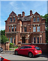
13 Green Hill, Worcester
In a style usually referred to as Queen Anne. Built as a vicarage by Yeates & Jones, 1883-84.
Image: © Stephen Richards
Taken: 17 Jul 2014
0.06 miles
4
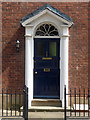
Detail of 16 Green Hill, Worcester
Early C19th doorcase with a pretty fanlight.
Image: © Stephen Richards
Taken: 17 Jul 2014
0.07 miles
5
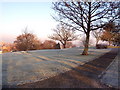
Winter in Fort Royal Park
Fort Royal's moment of fame came in September 1651, when the Royal Standard of King Charles II was raised here, in an attempt to regain power from Oliver Cromwell. The Battle of Worcester was the last military action of the post Civil War period, with "crowning glory" for Cromwell and a long flight for Charles to Shropshire, then in a circuitous route to the South coast and escape to France. Fort Royal is now a public park and a favourite with photographers for its excellent view of Worcester Cathedral.
Image: © John Stafford
Taken: 18 Dec 2003
0.07 miles
6
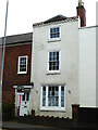
No. 66 London Road, Worcester
Three storey terraced house c1780-1820 and Listed Grade II.
See - https://britishlistedbuildings.co.uk/101389956-66-london-road-worcester-battenhall-ward
Image: © Chris Allen
Taken: 4 Sep 2021
0.08 miles
7
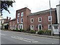
A row of Grade II Listed houses, London Road, Worcester
The four completely seen houses are from left to right Nos. 74, 72,70 and 68. On the extreme right is door for No. 66 that overlaps No. 68. The building on the extreme left is not listed.
Image: © Chris Allen
Taken: 4 Sep 2021
0.08 miles
8
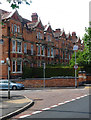
18-30 Battenhall Road, Worcester
A Queen Anne terrace by J. Cuddon Close, 1889. The top storey may be later. Pevsner notes the "Art Nouveau-like" balconies.
Image: © Stephen Richards
Taken: 17 Jul 2014
0.08 miles
9
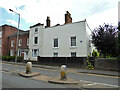
Nos. 68, 66 and 64 London Road, Worcester
From left to right. No. 70 is the three storey brick building on the extreme left. All three of these are Grade II Listed and date from 1780-1820.
Image: © Chris Allen
Taken: 4 Sep 2021
0.08 miles
10
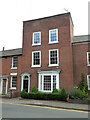
No. 70 London Road, Worcester
Three storey terraced house c1780-1820 and Listed Grade II.
Image: © Chris Allen
Taken: 4 Sep 2021
0.08 miles