
IMAGES TAKEN NEAR TO
Tyne Close, WORCESTER, WR5 1SE
Introduction
This page details the photographs taken nearby to Tyne Close, WR5 1SE by members of the Geograph project.
The Geograph project started in 2005 with the aim of publishing, organising and preserving representative images for every square kilometre of Great Britain, Ireland and the Isle of Man.

There are currently over 7.5m images from over14,400 individuals and you can help contribute to the project by visiting https://www.geograph.org.uk
Image Map
Images are licensed for reuse under creativecommons.org/licenses/by-sa/2.0
Notes
- Clicking on the map will re-center to the selected point.
- The higher the marker number, the further away the image location is from the centre of the postcode.
Image Listing (30 Images Found)
Images are licensed for reuse under creativecommons.org/licenses/by-sa/2.0
Image
Details
Distance
1
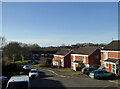
Tyne Close, Worcester
One of the streets named after rivers in this part of Worcester and seen from the footpath running along the edge of Perry Wood
Image: © Chris Allen
Taken: 9 Feb 2023
0.05 miles
2
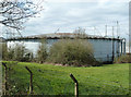
Gas holder, Worcester
A spiral guided multi-lift gas holder in the down position. I think this is out of use as some of the buildings on site appear insecure and there is a hole in the fence. This is labelled as No. 4 but is the only one now to be seen. I suspect the Lotus Lightweight Structures factory is on some of the former gasworks.
Image: © Chris Allen
Taken: 14 Apr 2013
0.07 miles
3
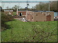
Gas holder ancillary buildings
Alongside a multi-lift spiral guided gas holder that I believe is decommissioned. The nearest building is the booster and governor house that maintained and controlled the gas main pressure on the outlet side of the holder. The back left building is the boiler house that would have prevented the water seal freezing and the back right building is the switch room. Surprisingly, there are no contact/emergency numbers on the gates to the site.
Image: © Chris Allen
Taken: 14 Apr 2013
0.07 miles
4
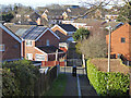
Path from Perry Wood to Medway Road, Worcester
Public footpath leading to one of the roads in the area that are named after rivers.
Image: © Chris Allen
Taken: 9 Feb 2023
0.09 miles
5
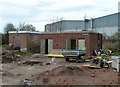
Gas holder ancillary buildings, Worcester
I believe the gas holder is decommissioned judging by the state of these buildings. The one on the right is the switch gear room and the one on the left is the boiler house. A boiler was needed to keep the sealing water heated in cold weather and prevent freezing. The big building beyond is lotus Lightweight Structures Ltd - a well hidden large building.
The photograph was taken through the gate with no trespass involved.
Image: © Chris Allen
Taken: 14 Apr 2013
0.09 miles
6
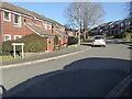
Hamble Close, Worcester
In an area where the streets are all named after rivers.
Image: © Chris Allen
Taken: 9 Feb 2023
0.11 miles
7
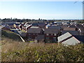
New housing development, Worcester
On the site of a large factory that was known locally as the Metal Box as it made tin cans. Seen from a path along the edge of Perry Wood.
Image: © Chris Allen
Taken: 9 Feb 2023
0.12 miles
8
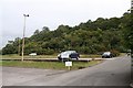
Perry Wood
Taken from Perry Wood Walk looking over the Crown car park.
Image: © Bob Embleton
Taken: 23 Sep 2007
0.15 miles
9
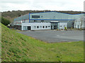
Lotus Lightweight Structures Ltd
This is a wholly owned subsidiary of Lotus Cars Ltd and makes bonded aluminium spaceframes for the automotive industry and other industries. This is a high-tech company that is well hidden behind tall trees. This view is through a fence on the main access road near the entrance to this and the Crown packaging plant.
Image: © Chris Allen
Taken: 14 Apr 2013
0.16 miles
10
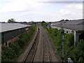
Looking NNW from bridge over Perry Wood road towards Shrub Hill Station.
Image: © Richard Dunn
Taken: 10 May 2005
0.16 miles