
IMAGES TAKEN NEAR TO
Fort Royal Hill, WORCESTER, WR5 1BT
Introduction
This page details the photographs taken nearby to Fort Royal Hill, WR5 1BT by members of the Geograph project.
The Geograph project started in 2005 with the aim of publishing, organising and preserving representative images for every square kilometre of Great Britain, Ireland and the Isle of Man.

There are currently over 7.5m images from over14,400 individuals and you can help contribute to the project by visiting https://www.geograph.org.uk
Image Map
Images are licensed for reuse under creativecommons.org/licenses/by-sa/2.0
Notes
- Clicking on the map will re-center to the selected point.
- The higher the marker number, the further away the image location is from the centre of the postcode.
Image Listing (537 Images Found)
Images are licensed for reuse under creativecommons.org/licenses/by-sa/2.0
Image
Details
Distance
1
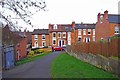
Looking to Fort Royal Hill from Fort Royal Park, Worcester
This is one of the entrances to the small Fort Royal Park.
Image: © P L Chadwick
Taken: 10 Mar 2012
0.02 miles
3
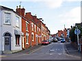
Fort Royal Hill, Worcester
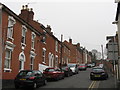
A rather congested residential back street, looking from its junction with Wylds Lane.
Image: © P L Chadwick
Taken: 10 Mar 2012
0.02 miles
5
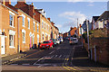
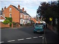
Fort Royal Hill, Worcester
This street runs to the north of the hill itself and is seen here from its junction with Wyld's Lane.
Image: © Stephen McKay
Taken: 5 Mar 2016
0.03 miles
6
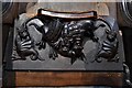
Worcester Cathedral: Choir stall misericord 1
Image: © Michael Garlick
Taken: 3 May 2019
0.04 miles
7
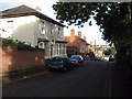
Houses on Cole Hill
Houses on Cole Hill in Worcester. Before the English Civil War, when this area became known as Fort Royal Hill after the Royalist Fort, this area was called Cole Hill after William Cole who in 1310 gave 30 years of land to the nearby Commandary which at the time was a hospital. The building of houses in this part of Worcester began in the 1860s.
Image: © Philip Halling
Taken: 28 Aug 2015
0.04 miles
8
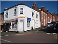
Watan Supermarket
A corner shop on Wyld's Lane called Watan Supermarket.
Image: © Philip Halling
Taken: 30 Jun 2015
0.04 miles
9
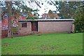
Disused building in Fort Royal Park, Worcester
This building on the edge of the park was originally used by park keepers. Later it was used for prayer meetings, but currently it is not in use.
Image: © P L Chadwick
Taken: 10 Mar 2012
0.04 miles
10
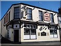
The Plumbers Arms
The Plumbers Arms on the corner of Wyld's Lane and Cole Hill in Worcester.
Image: © Philip Halling
Taken: 30 Jun 2015
0.04 miles