
IMAGES TAKEN NEAR TO
Lygon Walk, WORCESTER, WR4 9RG
Introduction
This page details the photographs taken nearby to Lygon Walk, WR4 9RG by members of the Geograph project.
The Geograph project started in 2005 with the aim of publishing, organising and preserving representative images for every square kilometre of Great Britain, Ireland and the Isle of Man.

There are currently over 7.5m images from over14,400 individuals and you can help contribute to the project by visiting https://www.geograph.org.uk
Image Map
Images are licensed for reuse under creativecommons.org/licenses/by-sa/2.0
Notes
- Clicking on the map will re-center to the selected point.
- The higher the marker number, the further away the image location is from the centre of the postcode.
Image Listing (56 Images Found)
Images are licensed for reuse under creativecommons.org/licenses/by-sa/2.0
Image
Details
Distance
1
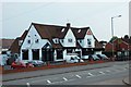
Altafs Balti, 166 Tolladine Road, Tolladine, Worcester
An Indian restaurant which also offers a takeaway service. At the other end of the building is the Farmers Boy public house. There is a signboard on a post in the car park which is shared by both the restaurant and the pub, each having one side.
Image: © P L Chadwick
Taken: 6 Sep 2014
0.02 miles
2
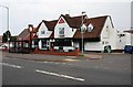
Farmers Boy (1), Tolladine Road, Tolladine, Worcester
The whole of this building used to be a public house but a few years ago it was converted into two units. The end nearest the camera remains as a public house, but the other end of the building is now an Indian restaurant known as Altafs Balti. The upper floors are used for staff accommodation.
Image
Image: © P L Chadwick
Taken: 6 Sep 2014
0.02 miles
3
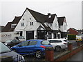
Altafs Balti, Tolladine Road, Worcester
Indian restaurant and takeaway.
Image: © Chris Allen
Taken: 27 Dec 2019
0.02 miles
4
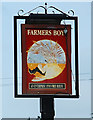
Farmers Boy (2) - sign, Tolladine Road, Tolladine, Worcester
The pub building, which is now shared with an Indian restaurant, appears to be older than the surrounding housing, so probably when it was built it was surrounded by farmland, hence the name.
According to the sign, which is on a post in the car park, the pub is part of the Enterprise Inns chain. The other side of the sign is actually a sign for the adjoining restaurant.
Image
Image: © P L Chadwick
Taken: 6 Sep 2014
0.02 miles
5
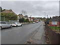
Tolladine Road, Worcester
The B4637 looking away from the city centre.
Image: © Chris Allen
Taken: 24 Nov 2022
0.03 miles
6
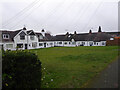
Housing on Balliol Road, Worcester
Single and two storey housing in a U shape with the open end by the road. I would welcome any history of this unusual appearing complex.
Image: © Chris Allen
Taken: 27 Dec 2019
0.05 miles
7
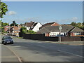
Tolladine Road, Worcester
Christchurch Road joins it on the right.
Image: © Chris Allen
Taken: 26 Sep 2019
0.05 miles
8
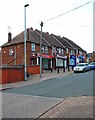
Four shop units in Rose Avenue, Tolladine, Worcester
Just off Tolladine Road, there are eight shop units in Rose Avenue serving the large Tolladine housing estate. On this side of Rose Avenue are half the units. These are occupied by a bookmakers, a butchers and two units are used by a convenience store which has an off-licence and includes a post office.
See also:- Image
Image: © P L Chadwick
Taken: 6 Sep 2014
0.06 miles
9
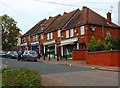
Another four shop units in Rose Avenue, Tolladine, Worcester
The four shops on this side of Rose Avenue are occupied by the Italian Job (a takeaway), Rose Avenue Fryer (fish & chip shop), M & R General Stores, and Worcester Angling Centre.
See also:- Image
Image: © P L Chadwick
Taken: 6 Sep 2014
0.07 miles
10
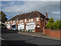
Closed shops, Rose Avenue, Tolladine
In 2014 these four shops were open - Image Now only the fish and chips shop is open. On the opposite side of the avenue were a further three shops in four former units. Now only one of these is open and its integral post office part has closed permanently. I didn't photograph those on the opposite side due to bad lighting.
Image: © Chris Allen
Taken: 26 Sep 2019
0.07 miles