
IMAGES TAKEN NEAR TO
Balliol Road, WORCESTER, WR4 9QQ
Introduction
This page details the photographs taken nearby to Balliol Road, WR4 9QQ by members of the Geograph project.
The Geograph project started in 2005 with the aim of publishing, organising and preserving representative images for every square kilometre of Great Britain, Ireland and the Isle of Man.

There are currently over 7.5m images from over14,400 individuals and you can help contribute to the project by visiting https://www.geograph.org.uk
Image Map
Images are licensed for reuse under creativecommons.org/licenses/by-sa/2.0
Notes
- Clicking on the map will re-center to the selected point.
- The higher the marker number, the further away the image location is from the centre of the postcode.
Image Listing (80 Images Found)
Images are licensed for reuse under creativecommons.org/licenses/by-sa/2.0
Image
Details
Distance
1
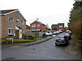
Somerville Road from Balliol Road, Worcester
It seems these two streets have been named after colleges at Oxford University. Classy if that is the link.
Image: © Chris Allen
Taken: 27 Dec 2019
0.02 miles
2
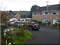
Merton Close, Worcester
This collection of streets that appear to be largely council housing are named after Oxford Colleges.
Image: © Chris Allen
Taken: 24 Nov 2022
0.03 miles
3
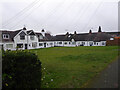
Housing on Balliol Road, Worcester
Single and two storey housing in a U shape with the open end by the road. I would welcome any history of this unusual appearing complex.
Image: © Chris Allen
Taken: 27 Dec 2019
0.05 miles
4
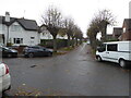
Christchurch Road, Worcester
These look like council (or former) council houses.
Image: © Chris Allen
Taken: 24 Nov 2022
0.06 miles
5
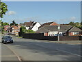
Tolladine Road, Worcester
Christchurch Road joins it on the right.
Image: © Chris Allen
Taken: 26 Sep 2019
0.09 miles
6
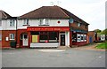
Newtown Road Cantonese Take-away, 41 Newtown Road, Worcester
A Chinese (Cantonese style) takeaway located on the corner of Newtown Road and Ronkswood Hill. Around the side at No. 43 Newtown Road, was Cowleys, newsagents, but the shop looked disused.
Image: © P L Chadwick
Taken: 6 Sep 2014
0.10 miles
7
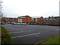
Turnpike House Medical Centre, Newtown Road, Worcester
Seen from the rear from a public footpath descending from the hill above.
Image: © Chris Allen
Taken: 27 Dec 2019
0.10 miles
8
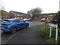
Oriel Close, Worcester
This collection of streets of apparent council houses all appear to have the names of Oxford colleges.
Image: © Chris Allen
Taken: 24 Nov 2022
0.10 miles
10
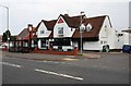
Farmers Boy (1), Tolladine Road, Tolladine, Worcester
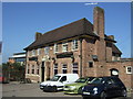
The whole of this building used to be a public house but a few years ago it was converted into two units. The end nearest the camera remains as a public house, but the other end of the building is now an Indian restaurant known as Altafs Balti. The upper floors are used for staff accommodation.
Image
Image: © P L Chadwick
Taken: 6 Sep 2014
0.11 miles