
IMAGES TAKEN NEAR TO
Shap Drive, WORCESTER, WR4 9NR
Introduction
This page details the photographs taken nearby to Shap Drive, WR4 9NR by members of the Geograph project.
The Geograph project started in 2005 with the aim of publishing, organising and preserving representative images for every square kilometre of Great Britain, Ireland and the Isle of Man.

There are currently over 7.5m images from over14,400 individuals and you can help contribute to the project by visiting https://www.geograph.org.uk
Image Map
Images are licensed for reuse under creativecommons.org/licenses/by-sa/2.0
Notes
- Clicking on the map will re-center to the selected point.
- The higher the marker number, the further away the image location is from the centre of the postcode.
Image Listing (82 Images Found)
Images are licensed for reuse under creativecommons.org/licenses/by-sa/2.0
Image
Details
Distance
1

Shap Drive, Warndon, Worcester
Part of the large Warndon estate of social housing.
Image: © Chris Allen
Taken: 2 May 2021
0.02 miles
2
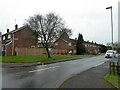
Shap Drive from Tolladine Road, Warndon, Worcester
Part of the large council housing estate.
Image: © Chris Allen
Taken: 20 Feb 2021
0.02 miles
3

Cartmel Close, Warndon, Worcester
From Shap Drive in the large Warndon estate of social housing.
Image: © Chris Allen
Taken: 2 May 2021
0.04 miles
4
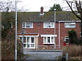
Tolladine Road from a path from Warndon Villages
This path leads past a grassy area behind the modern, private development of Warndon Villages to Tolladine Road in the social housing of Warndon. Allegedly there is a 12 year differential in life expectancy across this boundary.
Image: © Chris Allen
Taken: 20 Feb 2021
0.05 miles
5
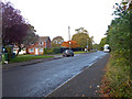
Tolladine Road, Warndon, Worcester
At this point Tolladine Road is the boundary between the older housing of Warndon to the left and the more modern housing development of Warndon Villages, out of sight to the right. The road ahead is a cul-de-sac leading to a school.
Image: © Chris Allen
Taken: 4 Nov 2019
0.05 miles
6
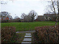
Grassy area in Warndon Villages
This is on the Warndon Villages side of Tolladine Road that forms a boundary between the older council estate of Warndon and the large modern development of Warndon Villages. Allegedly there is a 12 year difference in life expectancy between the two areas.
Image: © Chris Allen
Taken: 20 Feb 2021
0.05 miles
7
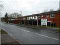
Martindale Close from Tolladine Road, Warndon, Worcester
A large council housing estate in Worcester.
Image: © Chris Allen
Taken: 20 Feb 2021
0.06 miles
8
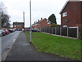
Thirlmere Close from Tolladine Road
The large Warndon housing estate in Worcester.
Image: © Chris Allen
Taken: 20 Feb 2021
0.06 miles
9
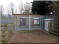
Gas installation, Tolladine road, Worcester
A natural gas installation that is probably a local pressure reducing station. This is between the older Warndon estate of social housing and the new Warndon Villages development.
Image: © Chris Allen
Taken: 6 Mar 2021
0.07 miles
10
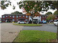
Hawkshead Court, Warndon, Worcester
Part of a large council housing estate in Worcester.
Image: © Chris Allen
Taken: 9 Oct 2022
0.07 miles