
IMAGES TAKEN NEAR TO
Cherwell Close, WORCESTER, WR4 9BN
Introduction
This page details the photographs taken nearby to Cherwell Close, WR4 9BN by members of the Geograph project.
The Geograph project started in 2005 with the aim of publishing, organising and preserving representative images for every square kilometre of Great Britain, Ireland and the Isle of Man.

There are currently over 7.5m images from over14,400 individuals and you can help contribute to the project by visiting https://www.geograph.org.uk
Image Map
Images are licensed for reuse under creativecommons.org/licenses/by-sa/2.0
Notes
- Clicking on the map will re-center to the selected point.
- The higher the marker number, the further away the image location is from the centre of the postcode.
Image Listing (49 Images Found)
Images are licensed for reuse under creativecommons.org/licenses/by-sa/2.0
Image
Details
Distance
1
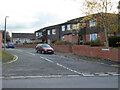
Cherwell Close, Worcester
From Tolladine Road.
Image: © Chris Allen
Taken: 3 Nov 2021
0.06 miles
2
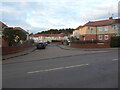
Portefields Road, Worcester
Seen across Tolladine Road and having the appearance of a council housing estate. Gorse Hill is seen behind and is wooded.
Image: © Chris Allen
Taken: 3 Nov 2021
0.08 miles
3
Ronkswood
An open green space in Worcester.
Image: © Bob Embleton
Taken: 20 Jun 2005
0.09 miles
4
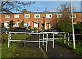
Avon Road, Tolladine, Worcester
Seen from the path to Don Road that in turn connects to Ronkswood Hill. This provides an on foot connection between two estates that are quite a distance apart in a vehicle. The terrace opposite has a flat roof and there are several units of this type in this estate.
Image: © Chris Allen
Taken: 1 Dec 2020
0.09 miles
5
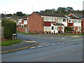
Kenwood Avenue, Worcester
Seen from Tolladine Road.
Image: © Chris Allen
Taken: 3 Nov 2021
0.09 miles
6

Junction of Conway and Tolladine Road, Worcester
Image: © Chris Allen
Taken: 1 Dec 2020
0.09 miles
7
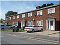
58-64 Avon Road, Worcester
Part of a cluster of council housing of the 1940s or early c1950s. The porches and windows have concrete frames.
Image: © Stephen Richards
Taken: 17 Jul 2014
0.10 miles
8
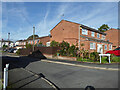
Chiltern Close, Worcester
Off Kenwood Avenue that is off Tolladine Road.
Image: © Chris Allen
Taken: 25 Oct 2022
0.11 miles
9
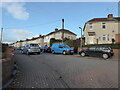
Maple Avenue, Worcester
This has the appearance of current/former council housing.
Image: © Chris Allen
Taken: 3 Nov 2021
0.11 miles
10
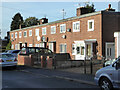
Avon Road, Tolladine, Worcester
There are various designs of council house (or former council house) on Avon Road and there are quite a few of these terraces with flat roofs.
Image: © Chris Allen
Taken: 1 Dec 2020
0.11 miles