
IMAGES TAKEN NEAR TO
Tolladine Road, WORCESTER, WR4 9AU
Introduction
This page details the photographs taken nearby to Tolladine Road, WR4 9AU by members of the Geograph project.
The Geograph project started in 2005 with the aim of publishing, organising and preserving representative images for every square kilometre of Great Britain, Ireland and the Isle of Man.

There are currently over 7.5m images from over14,400 individuals and you can help contribute to the project by visiting https://www.geograph.org.uk
Image Map
Images are licensed for reuse under creativecommons.org/licenses/by-sa/2.0
Notes
- Clicking on the map will re-center to the selected point.
- The higher the marker number, the further away the image location is from the centre of the postcode.
Image Listing (56 Images Found)
Images are licensed for reuse under creativecommons.org/licenses/by-sa/2.0
Image
Details
Distance
1
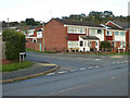
Kenwood Avenue, Worcester
Seen from Tolladine Road.
Image: © Chris Allen
Taken: 3 Nov 2021
0.03 miles
2

Junction of Conway and Tolladine Road, Worcester
Image: © Chris Allen
Taken: 1 Dec 2020
0.04 miles
3
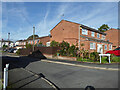
Chiltern Close, Worcester
Off Kenwood Avenue that is off Tolladine Road.
Image: © Chris Allen
Taken: 25 Oct 2022
0.05 miles
4
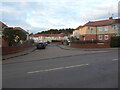
Portefields Road, Worcester
Seen across Tolladine Road and having the appearance of a council housing estate. Gorse Hill is seen behind and is wooded.
Image: © Chris Allen
Taken: 3 Nov 2021
0.07 miles
5
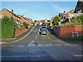
Lutterworth Close, Worcester
Off Tolladine Road.
Image: © Chris Allen
Taken: 1 Dec 2020
0.07 miles
6
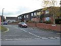
Cherwell Close, Worcester
From Tolladine Road.
Image: © Chris Allen
Taken: 3 Nov 2021
0.07 miles
7
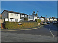
Avon Road, Tolladine, Worcester
Older council housing stock with some corrugated cladding. This estate has a variety of older housing stock and this design extends up the road as far as you can see.
Image: © Chris Allen
Taken: 1 Dec 2020
0.08 miles
8
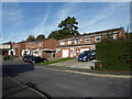
Mendip Close
Off Kenwood Avenue, Worcester.
Image: © Chris Allen
Taken: 25 Oct 2022
0.08 miles
9
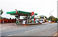
Tolladine Service Station, Tolladine Road, Tolladine, Worcester
This is both a garage and a fuel filling station. The business is family run with over forty years of experience.
Other photos:-
Image
Image
Image
Image: © P L Chadwick
Taken: 6 Sep 2014
0.10 miles
10
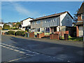
Houses on Conway, Worcester
Conway is this road's given name without any qualifier such as road, street or close. There is quite a large enclave of this design of houses that almost certainly are, or were, council houses. I am not sure whether these would qualify as 'prefabricated' houses and it is hard to find out anything about Worcester's fleet of council houses (numbers, styles and dates for example). There has been a lot of rebuilding on the Ronkswood estate but this Tolladine estate appears to have a larger unmodernised stock. I would welcome any more expert information on Worcester's housing.
Thomas Nugent has identified these as being in keeping with BISF (British Iron and steel Federation) houses. I agree, they do look like these - Image There is a description here - https://en.wikipedia.org/wiki/BISF_house
The description points out that these were not built as temporary homes, have a lifespan in keeping with a brick built house and remain mortgageable.
Image: © Chris Allen
Taken: 1 Dec 2020
0.10 miles