
IMAGES TAKEN NEAR TO
Avon Road, WORCESTER, WR4 9AG
Introduction
This page details the photographs taken nearby to Avon Road, WR4 9AG by members of the Geograph project.
The Geograph project started in 2005 with the aim of publishing, organising and preserving representative images for every square kilometre of Great Britain, Ireland and the Isle of Man.

There are currently over 7.5m images from over14,400 individuals and you can help contribute to the project by visiting https://www.geograph.org.uk
Image Map
Images are licensed for reuse under creativecommons.org/licenses/by-sa/2.0
Notes
- Clicking on the map will re-center to the selected point.
- The higher the marker number, the further away the image location is from the centre of the postcode.
Image Listing (54 Images Found)
Images are licensed for reuse under creativecommons.org/licenses/by-sa/2.0
Image
Details
Distance
1
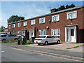
58-64 Avon Road, Worcester
Part of a cluster of council housing of the 1940s or early c1950s. The porches and windows have concrete frames.
Image: © Stephen Richards
Taken: 17 Jul 2014
0.04 miles
2
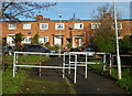
Avon Road, Tolladine, Worcester
Seen from the path to Don Road that in turn connects to Ronkswood Hill. This provides an on foot connection between two estates that are quite a distance apart in a vehicle. The terrace opposite has a flat roof and there are several units of this type in this estate.
Image: © Chris Allen
Taken: 1 Dec 2020
0.05 miles
3
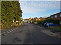
Avon Road at the junction with Dee Way, Warndon, Worcester
Image: © Jeff Gogarty
Taken: 2 Dec 2021
0.07 miles
4
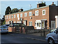
Avon Road, Tolladine, Worcester
There are various designs of council house (or former council house) on Avon Road and there are quite a few of these terraces with flat roofs.
Image: © Chris Allen
Taken: 1 Dec 2020
0.08 miles
5
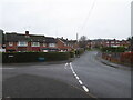
The junction of Wolsey Close and Don Road, Worcester
These properties have the look of council/social housing. There is an awful lot in Worcester. Wolsey close is to the left and Don road straight ahead.
Image: © Chris Allen
Taken: 27 Dec 2019
0.08 miles
6
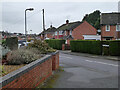
Wolsey Close from Don Road, Worcester
This area off Newtown Road has the look of council housing.
Image: © Chris Allen
Taken: 27 Dec 2019
0.09 miles
7
Ronkswood
An open green space in Worcester.
Image: © Bob Embleton
Taken: 20 Jun 2005
0.11 miles
8
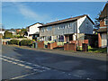
Houses on Conway, Worcester
Conway is this road's given name without any qualifier such as road, street or close. There is quite a large enclave of this design of houses that almost certainly are, or were, council houses. I am not sure whether these would qualify as 'prefabricated' houses and it is hard to find out anything about Worcester's fleet of council houses (numbers, styles and dates for example). There has been a lot of rebuilding on the Ronkswood estate but this Tolladine estate appears to have a larger unmodernised stock. I would welcome any more expert information on Worcester's housing.
Thomas Nugent has identified these as being in keeping with BISF (British Iron and steel Federation) houses. I agree, they do look like these - Image There is a description here - https://en.wikipedia.org/wiki/BISF_house
The description points out that these were not built as temporary homes, have a lifespan in keeping with a brick built house and remain mortgageable.
Image: © Chris Allen
Taken: 1 Dec 2020
0.13 miles
9
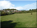
Ronkswood Hill Meadows Local Nature Reserve
This is only about 1 mile from the centre of Worcester (the Cross) and is surrounded by urban sprawl. In the summer, cows graze here. The wood to the left of centre is Elbury Mount and to the right the land is rising to Leopard Hill. It is all suggestive of a more rural idyll than being close to the centre of a city.
Image: © Chris Allen
Taken: 27 Sep 2019
0.13 miles
10
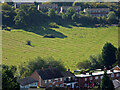
A field between Avon Road and Newtown road, Worcester
Used for grazing in summer and showing features suggestive of a ridge and furrow system. Newtown Road is in the background.
Image: © Chris Allen
Taken: 18 Sep 2019
0.13 miles