
IMAGES TAKEN NEAR TO
Albany Road, WORCESTER, WR3 8EY
Introduction
This page details the photographs taken nearby to Albany Road, WR3 8EY by members of the Geograph project.
The Geograph project started in 2005 with the aim of publishing, organising and preserving representative images for every square kilometre of Great Britain, Ireland and the Isle of Man.

There are currently over 7.5m images from over14,400 individuals and you can help contribute to the project by visiting https://www.geograph.org.uk
Image Map
Images are licensed for reuse under creativecommons.org/licenses/by-sa/2.0
Notes
- Clicking on the map will re-center to the selected point.
- The higher the marker number, the further away the image location is from the centre of the postcode.
Image Listing (72 Images Found)
Images are licensed for reuse under creativecommons.org/licenses/by-sa/2.0
Image
Details
Distance
1

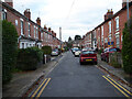
Albany Road, Worcester
A road of older housing stock seen from the junction with Tunnel Hill
Image: © Chris Allen
Taken: 12 Jul 2021
0.02 miles
2
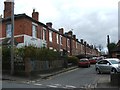
Albany Road, Worcester
Older housing stock seen from Vicar Street.
Image: © Chris Allen
Taken: 3 Nov 2021
0.03 miles
5

Railway - signal and tunnel mouth, Worcester
This is the line towards Droitwich and Birmingham (via Lickey Incline) just after Worcester Tunnel Junction signal Box. The signals are mechanically operated semaphores and typical of the 'Worcester patch', which is a stronghold of steam age signalling technologies. This is a strictly no trespass picture.
Image: © Chris Allen
Taken: 14 Feb 2015
0.05 miles
6

Up freight emerging from Rainbow Hill Tunnel, Worcester
View NE, towards Droitwich Spa and Birmingham/Wolverhampton via Bromsgrove/Kidderminster; ex-GWR Worcester - Birmingham (Snow Hill)/Wolverhampton main line, joint to Stoke Works Junction with ex-Midland to Birmingham (New St.) via Bromsgrove. The Class F freight is headed by Churchward 43XX 2-6-0 No. 6324 (built 3/21, withdrawn 4/62): it is signalled to go left at Tunnel Junction to go south towards Evesham, Oxford etc. (See also Image] and Image)
Image: © Ben Brooksbank
Taken: 22 Jul 1947
0.05 miles
7
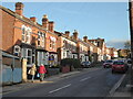
Tunnel Hill, Worcester
Older housing stock near the junction with Rainbow Hill.
Image: © Chris Allen
Taken: 3 Nov 2021
0.05 miles
10
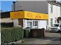
Chinese takeaway, Vicar Street, Worcester
Image: © Chris Allen
Taken: 12 Feb 2024
0.06 miles