
IMAGES TAKEN NEAR TO
Cypress Street, WORCESTER, WR3 8AU
Introduction
This page details the photographs taken nearby to Cypress Street, WR3 8AU by members of the Geograph project.
The Geograph project started in 2005 with the aim of publishing, organising and preserving representative images for every square kilometre of Great Britain, Ireland and the Isle of Man.

There are currently over 7.5m images from over14,400 individuals and you can help contribute to the project by visiting https://www.geograph.org.uk
Image Map
Images are licensed for reuse under creativecommons.org/licenses/by-sa/2.0
Notes
- Clicking on the map will re-center to the selected point.
- The higher the marker number, the further away the image location is from the centre of the postcode.
Image Listing (96 Images Found)
Images are licensed for reuse under creativecommons.org/licenses/by-sa/2.0
Image
Details
Distance
1
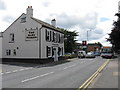
The Alma Tavern
At the corner of Droitwich Road (A38) and - of course - Alma Street.
Image: © Peter Whatley
Taken: 23 Jun 2008
0.04 miles
2
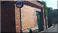
Electricity Sub Station, Crown Street, Worcester
Image: © V1ncenze
Taken: 3 Sep 2019
0.04 miles
3
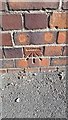
Bench mark on Electricity Sub station
Bench mark found on Crown Street, Worcester electricity sub station.
Image: © V1ncenze
Taken: 3 Sep 2019
0.04 miles
4
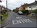
Melbourne Street, Barbourne, Worcester
Image: © Jeff Gogarty
Taken: 14 Aug 2016
0.05 miles
5
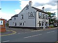
The Alma Tavern, 74 Droitwich Road
On the corner of Alma Street and Droitwich Road (the A38). Not to be confused with the Alma Inn in Mill Street, Diglis, which was unfortunately recently knocked down to make way for a private school.
Image
Image: © P L Chadwick
Taken: 19 Jun 2010
0.05 miles
6
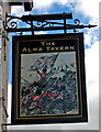
The Alma Tavern (pub sign), 74 Droitwich Road
The Battle of Alma was the first major engagement of the Crimean War, and took place in 1854. British, French & Turkish troops fought against the Russians, who lost this battle. It inspired a lot of British pubs to be named after it, and even today, over 150 years later, many survive. Worcester had at least two, but The Alma Inn in Diglis was demolished a year or so back to make way for a private school.
Image
Image: © P L Chadwick
Taken: 19 Jun 2010
0.05 miles
7
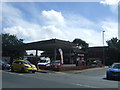
Service station on Droitwich Road, Worcester
Image: © JThomas
Taken: 22 Jul 2017
0.06 miles
8
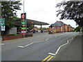
Texaco filling station, Droitwich Road, Worcester
Barbourne Health Centre is the next building to the right.
Image: © Chris Allen
Taken: 25 Aug 2021
0.06 miles
9
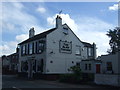
The Alma Tavern, Barbourne, Worcester
On Droitwich Road.
Image: © JThomas
Taken: 22 Jul 2017
0.06 miles
10
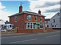
Wishing Well Nursery, 76 Droitwich Road
On the corner of Droitwich Road (the A38) and Alma Street, the nursery was established in 1994. It has four nursery sites, of which this is the largest, and one after school provision.
Image: © P L Chadwick
Taken: 19 Jun 2010
0.06 miles