
IMAGES TAKEN NEAR TO
New Bank Street, WORCESTER, WR3 8AN
Introduction
This page details the photographs taken nearby to New Bank Street, WR3 8AN by members of the Geograph project.
The Geograph project started in 2005 with the aim of publishing, organising and preserving representative images for every square kilometre of Great Britain, Ireland and the Isle of Man.

There are currently over 7.5m images from over14,400 individuals and you can help contribute to the project by visiting https://www.geograph.org.uk
Image Map
Images are licensed for reuse under creativecommons.org/licenses/by-sa/2.0
Notes
- Clicking on the map will re-center to the selected point.
- The higher the marker number, the further away the image location is from the centre of the postcode.
Image Listing (189 Images Found)
Images are licensed for reuse under creativecommons.org/licenses/by-sa/2.0
Image
Details
Distance
1

Ordnance Survey Cut Mark
Cut mark on wall outside number 8 Droitwich Road. These marks were used by Ordnance Survey for mapping purposes.
Image: © V1ncenze
Taken: 28 Sep 2019
0.06 miles
2

Worcester Old Toll House
View from No 8 Droitwich Rd, Worcester towards the Old Toll house. The Toll House is octagonal in shape.
Image: © V1ncenze
Taken: 28 Sep 2019
0.07 miles
3
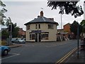
The Old Toll House, Barbourne
Situated at the junction of the A38 and the A449. This building is approximately 200 years old and was one of several 'Toll Houses' that used to exist on the highways into Worcester
Image: © Derek Bradley
Taken: 18 May 2007
0.08 miles
4
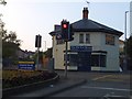
The Old Toll House, Barbourne, Worcester
Image: © David Smith
Taken: 19 May 2013
0.10 miles
5
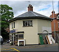
Old Toll House by the A38, Droitwich Road, Barbourne
Claines & side (& weigh engine) by the A38, in parish of Worcester (Worcester District), The Old Toll House (Octagonal Lodge), No. 1, Droitwich Road junction with Ombersley Road.
Grade II listed.
List Entry Number: 1389771 https://historicengland.org.uk/listing/the-list/list-entry/1389771
Surveyed
Milestone Society National ID: WO.WOR
Image: © Alan Rosevear
Taken: 21 May 2005
0.10 miles
6
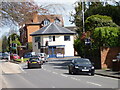
Junction of the A38 and A449 with former Toll House
Barbourne, Worcester.
Image: © Jeff Gogarty
Taken: 25 Apr 2023
0.10 miles
7
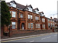
Houses on Ombersley Road, Barbourne, Worcester
Image: © Jeff Gogarty
Taken: 14 Aug 2016
0.10 miles
8
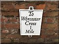
Replica Mileplate, A38, Barbourne Road, Barbourne
The mileplate is attached to the low wall next between no 98 and no 98A, on the east side of the road. One of six replica mileplates installed by the Worcester Group of the Milestone Society in 2018; original milestone was erected by the Worcester Turnpike Trust in the 19th century.
Inscription reads:-
To / Worcester / Cross / 1 Mile
Milestone Society National ID: WO_WOBM01R
Image: © Jan Scrine
Taken: 9 Apr 2019
0.10 miles
9
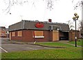
The former Deers Leap (1) - a doomed public house, 42 Droitwich Road
Although the present building looks as though it dates from maybe the 1960's or 70's, there has apparently been a pub on this site for over 300 years. That has now ended, as a controversial planning application was approved late in 2010 to demolish the pub, and replace it with a large state-of-the-art GP medical centre. This will cost around £3.5 million and include a pharmacy. The pub has already closed and awaits the bulldozers.
Image
Image
Image: © P L Chadwick
Taken: 4 Jan 2011
0.10 miles
10
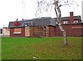
The former Deers Leap (2) - awaiting demolition, 42 Droitwich Road
This modern pub closed in late 2010 and now awaits demolition. It is to be replaced by a medical centre. The area behind the trellis fence was an outdoor smoking area, provided following the banning of smoking in pubs etc. The building behind the high wall is also part of the pub; the first floor being accommodation for the landlord and family. Outside the pub, adjacent to the front boundary wall, was a post from which hung a traditional pub sign. The post remains but unfortunately the sign had gone - too late to be photographed. However the oval red sign with the pub's name remains, as can be seen in this view.
Image
Image
Image: © P L Chadwick
Taken: 4 Jan 2011
0.10 miles