
IMAGES TAKEN NEAR TO
Morrin Close, WORCESTER, WR3 7PF
Introduction
This page details the photographs taken nearby to Morrin Close, WR3 7PF by members of the Geograph project.
The Geograph project started in 2005 with the aim of publishing, organising and preserving representative images for every square kilometre of Great Britain, Ireland and the Isle of Man.

There are currently over 7.5m images from over14,400 individuals and you can help contribute to the project by visiting https://www.geograph.org.uk
Image Map
Images are licensed for reuse under creativecommons.org/licenses/by-sa/2.0
Notes
- Clicking on the map will re-center to the selected point.
- The higher the marker number, the further away the image location is from the centre of the postcode.
Image Listing (17 Images Found)
Images are licensed for reuse under creativecommons.org/licenses/by-sa/2.0
Image
Details
Distance
1
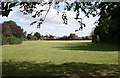
Recreation Ground, Claines
Located between the British Legion and the Scout and Guide hut.
Image: © Bob Embleton
Taken: 16 Sep 2007
0.06 miles
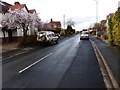
3

Claines Recreation Ground, Cornmeadow Lane, Claines, Worcester
The recreation ground extends quite some way back from the road. A football pitch can be seen in the distance.
Image: © P L Chadwick
Taken: 4 Aug 2013
0.09 miles
4

Junction of Cornmeadow Lane and Whinfield Road, Claines, Worcester
Whinfield Road is the road going off on the right. Both roads are mainly residential.
Image: © P L Chadwick
Taken: 4 Aug 2013
0.12 miles
5

Claines Royal British Legion Club (2), Cornmeadow Lane, Claines, Worcester
There is a Banks's sign above the club's name, indicating that the beers of this well-known West Midlands brewery are sold here.
Image
Image: © P L Chadwick
Taken: 4 Aug 2013
0.12 miles
6

Claines Royal British Legion Club (1), Cornmeadow Lane, Claines, Worcester
Claines is an old village which has now extended to become a northern suburb of the City of Worcester. It has its own Royal British Legion Club which is in the newer part of Claines.
Image
Image: © P L Chadwick
Taken: 4 Aug 2013
0.12 miles
7
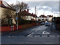
Junction of Cornmeadow Lane with Ombersely Road
Image: © Norman Caesar
Taken: 4 Mar 2017
0.21 miles
8
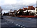
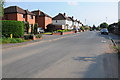
Ombersley Road, Northwick, North Worcester
Image: © Norman Caesar
Taken: 4 Mar 2017
0.21 miles
10
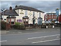
The New Inn
The New Inn on Ombersley Road.
Image: © Philip Halling
Taken: 28 Mar 2015
0.22 miles