
IMAGES TAKEN NEAR TO
Droitwich Road, WORCESTER, WR3 7JB
Introduction
This page details the photographs taken nearby to Droitwich Road, WR3 7JB by members of the Geograph project.
The Geograph project started in 2005 with the aim of publishing, organising and preserving representative images for every square kilometre of Great Britain, Ireland and the Isle of Man.

There are currently over 7.5m images from over14,400 individuals and you can help contribute to the project by visiting https://www.geograph.org.uk
Image Map
Images are licensed for reuse under creativecommons.org/licenses/by-sa/2.0
Notes
- Clicking on the map will re-center to the selected point.
- The higher the marker number, the further away the image location is from the centre of the postcode.
Image Listing (80 Images Found)
Images are licensed for reuse under creativecommons.org/licenses/by-sa/2.0
Image
Details
Distance
1
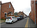
Perdiswell Street, Worcester
Note the old blue enamel street name on the left.
Image: © Chris Allen
Taken: 25 Aug 2021
0.02 miles
3
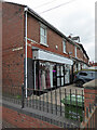
Be You at Gatehouse Brides, Droitwich Road, Worcester
The street name on the left is for Hungerpit Walk while the one to its right is for Droitwich Road. I took this for the unusual street name rather than for the bridal shop.
Image: © Chris Allen
Taken: 25 Aug 2021
0.04 miles
4
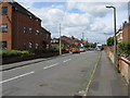
Penbury Street, off Droitwich Road, Worcester
Penbury Street on the west side of Droitwich Road (A38).
Image: © Peter Whatley
Taken: 23 Jun 2008
0.04 miles
5
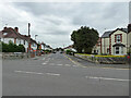
Blanquettes Avenue, Worcester
Seen across the A38, Droitwich Road.
Image: © Chris Allen
Taken: 25 Aug 2021
0.05 miles
6
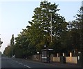
Bus stop, Droitwich Road, Worcester
The stop and shelter are close to the junction with Penbury Road (on left) and Beech Avenue (just beyond the shelter)
Image: © David Smith
Taken: 19 May 2013
0.07 miles
7
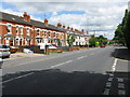
Droitwich Road
The A38 almost out of Worcester's suburbia. Taken from the junction with Beech Avenue.
Image: © Peter Whatley
Taken: 23 Jun 2008
0.07 miles
8
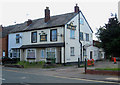
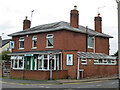
The Bell (former public house), 49 Droitwich Road
This was a Greenalls public house, according to the two signs on the front and side of the building. Greenalls stopped brewing themselves in 1991, and since then their remaining business interests have passed through several different owners. Following the closure of The Bell as a pub, the premises have been used by Bell Cars (Worcester) Limited, a taxi and private hire firm. When this photograph was taken in June 2010, the front downstairs windows were covered inside with sheets of newspapers. It wasn't clear whether the firm were still operating from this address.
At the side of the building is a narrow passageway called Belmont Walk.
Image
Image: © P L Chadwick
Taken: 19 Jun 2010
0.09 miles
9
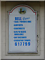
Bell Cars sign, 49 Droitwich Road
The Bell Cars sign has been fitted over what appears to have been an earlier sign, probably dating from the time when this building was a public house called The Bell.
Image
Image: © P L Chadwick
Taken: 19 Jun 2010
0.09 miles
10
Wishing Well Nursery, Droitwich Road, Aorcester
Alma Street is seen on the right hand side of the nursery.
Image: © Chris Allen
Taken: 25 Aug 2021
0.10 miles