
IMAGES TAKEN NEAR TO
Ombersley Road, WORCESTER, WR3 7BW
Introduction
This page details the photographs taken nearby to Ombersley Road, WR3 7BW by members of the Geograph project.
The Geograph project started in 2005 with the aim of publishing, organising and preserving representative images for every square kilometre of Great Britain, Ireland and the Isle of Man.

There are currently over 7.5m images from over14,400 individuals and you can help contribute to the project by visiting https://www.geograph.org.uk
Image Map
Images are licensed for reuse under creativecommons.org/licenses/by-sa/2.0
Notes
- Clicking on the map will re-center to the selected point.
- The higher the marker number, the further away the image location is from the centre of the postcode.
Image Listing (142 Images Found)
Images are licensed for reuse under creativecommons.org/licenses/by-sa/2.0
Image
Details
Distance
1
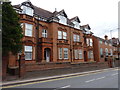
Houses on Ombersley Road, Barbourne, Worcester
Image: © Jeff Gogarty
Taken: 14 Aug 2016
0.02 miles
2
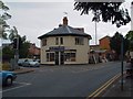
The Old Toll House, Barbourne
Situated at the junction of the A38 and the A449. This building is approximately 200 years old and was one of several 'Toll Houses' that used to exist on the highways into Worcester
Image: © Derek Bradley
Taken: 18 May 2007
0.04 miles
3
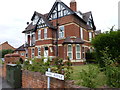
House on the corner
Of Park Avenue and Ombersley Road, Harbourne, Worcester.
Image: © Jeff Gogarty
Taken: 14 Aug 2016
0.04 miles
4
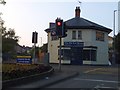
The Old Toll House, Barbourne, Worcester
Image: © David Smith
Taken: 19 May 2013
0.05 miles
5

Worcester Old Toll House
View from No 8 Droitwich Rd, Worcester towards the Old Toll house. The Toll House is octagonal in shape.
Image: © V1ncenze
Taken: 28 Sep 2019
0.06 miles
6

Ordnance Survey Cut Mark
Cut mark on wall outside number 8 Droitwich Road. These marks were used by Ordnance Survey for mapping purposes.
Image: © V1ncenze
Taken: 28 Sep 2019
0.06 miles
7
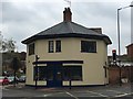
Old Toll House by the A38/A449 junction, Worcester
Claines & side (& weigh engine) by the A38, in parish of WORCESTER (Worcester District), The Old Toll House (Octagonal Lodge), No. 1, Droitwich Road jct with Ombersley Road.
Surveyed
Milestone Society National ID: WO.WOR
Image: © Jan Scrine
Taken: 9 Apr 2019
0.06 miles
8
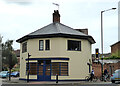
Former toll house, Barbourne, Worcester
At the junction of the A38 and A449. Formerly a shop but currently looking closed down.
Image: © Chris Allen
Taken: 16 Aug 2021
0.06 miles
9
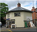
Old Toll House by the A38, Droitwich Road, Barbourne
Claines & side (& weigh engine) by the A38, in parish of Worcester (Worcester District), The Old Toll House (Octagonal Lodge), No. 1, Droitwich Road junction with Ombersley Road.
Grade II listed.
List Entry Number: 1389771 https://historicengland.org.uk/listing/the-list/list-entry/1389771
Surveyed
Milestone Society National ID: WO.WOR
Image: © Alan Rosevear
Taken: 21 May 2005
0.06 miles
10
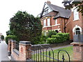
House on Ombersley Road, Barbourne, Worcester
Image: © Jeff Gogarty
Taken: 14 Aug 2016
0.06 miles