
IMAGES TAKEN NEAR TO
Beech Tree Way, WORCESTER, WR2 6RU
Introduction
This page details the photographs taken nearby to Beech Tree Way, WR2 6RU by members of the Geograph project.
The Geograph project started in 2005 with the aim of publishing, organising and preserving representative images for every square kilometre of Great Britain, Ireland and the Isle of Man.

There are currently over 7.5m images from over14,400 individuals and you can help contribute to the project by visiting https://www.geograph.org.uk
Image Map
Images are licensed for reuse under creativecommons.org/licenses/by-sa/2.0
Notes
- Clicking on the map will re-center to the selected point.
- The higher the marker number, the further away the image location is from the centre of the postcode.
Image Listing (25 Images Found)
Images are licensed for reuse under creativecommons.org/licenses/by-sa/2.0
Image
Details
Distance
1

New houses at Lower Broadheath
New houses built by Taylor Wimpey at Lower Broadheath on the Scarlet Pippin Orchard housing development.
Image: © Philip Halling
Taken: 18 Jul 2015
0.04 miles
2

Scarlet Pippin Orchard development
The sales office for the Taylor Wimpey Scarlet Pippin Orchard housing development at Lower Broadheath.
Image: © Philip Halling
Taken: 18 Jul 2015
0.04 miles
3

Scarlet Pippin Orchard sales office
The sales office for the Taylor Wimpey Scarlet Pippin Orchard housing development at Lower Broadheath.
Image: © Philip Halling
Taken: 18 Jul 2015
0.04 miles
4

Lower Broadheath - derelict structure
There are no immediate clues as to what this was: it is immediately off the B4204, almost opposite an old chapel now used as a house.
Image: © Peter Whatley
Taken: 31 Jul 2008
0.05 miles
5

New housing development
This housing development in Lower Broadheath has been built in the last ten years on a field Image
Image: © Philip Halling
Taken: 18 Apr 2021
0.07 miles
6
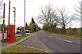
Bell Lane, Lower Broadheath
Part of the straggly village of Lower Broadheath.
Image
Image: © P L Chadwick
Taken: 27 Dec 2011
0.08 miles
7

Converted chapel in Broadheath
This converted chapel on the B4204 in Broadheath dates from 1825 according to the engraved stone on the gable.
Image: © Philip Halling
Taken: 24 Jan 2010
0.09 miles
8

Telephone kiosk in Bell Lane, Lower Broadheath
Located outside the car park of the Bell Inn.
Image
Image: © P L Chadwick
Taken: 27 Dec 2011
0.10 miles

10

Bell Inn, Broadheath
The Bell Inn is situated on a crossroads in the centre of the village of Broadheath.
Image: © Philip Halling
Taken: 24 Jan 2010
0.11 miles