
IMAGES TAKEN NEAR TO
Potters Meadow, WR2 6BT
Introduction
This page details the photographs taken nearby to Potters Meadow, WR2 6BT by members of the Geograph project.
The Geograph project started in 2005 with the aim of publishing, organising and preserving representative images for every square kilometre of Great Britain, Ireland and the Isle of Man.

There are currently over 7.5m images from over14,400 individuals and you can help contribute to the project by visiting https://www.geograph.org.uk
Image Map
Images are licensed for reuse under creativecommons.org/licenses/by-sa/2.0
Notes
- Clicking on the map will re-center to the selected point.
- The higher the marker number, the further away the image location is from the centre of the postcode.
Image Listing (28 Images Found)
Images are licensed for reuse under creativecommons.org/licenses/by-sa/2.0
Image
Details
Distance
3
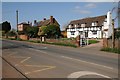
Houses in Hallow
A timber-framed cottage in Hallow.
Image: © Philip Halling
Taken: 14 Apr 2018
0.12 miles
4
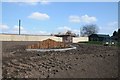
Building site in Hallow
Building site beside the A443 in Hallow.
Image: © Philip Halling
Taken: 14 Apr 2018
0.14 miles
5
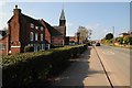
The A443 passing through Hallow
The primary school can be seen on the left beyond the house on the left.
Image: © Philip Halling
Taken: 14 Apr 2018
0.15 miles
6
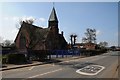
Hallow school
Hallow primary school viewed from the passing A443.
Image: © Philip Halling
Taken: 14 Apr 2018
0.15 miles
7
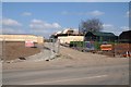
Building site in Hallow
Building site beside the A443 in Hallow.
Image: © Philip Halling
Taken: 14 Apr 2018
0.15 miles
8
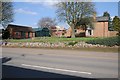
House and sheds in Hallow
This house and its shed beside the A443 are surrounded by a building site.
Image: © Philip Halling
Taken: 14 Apr 2018
0.16 miles
9
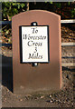
Replica Milestone by the A443, Hallow village
Metal plate attached to stone post by the A443, in parish of Hallow (MALVERN HILLS District), opposite Archbell Cottages, just South of Pinchfield Gardens, against metal rail fence by drive to Jessamine, on Northeast side of road. Worcester Cross iron plate - original erected by the Worcester turnpike trust in the 19th century.
Inscription reads:-
To
Worcester
Cross
3
Miles
Milestone Society National ID: WO_WOGW03
Image: © J Higgins
Taken: 20 Dec 2014
0.16 miles
10

A garden with ambition, Green Park, Hallow
Image: © Jeff Gogarty
Taken: 10 Nov 2022
0.18 miles