
IMAGES TAKEN NEAR TO
WR2 5UT
Introduction
This page details the photographs taken nearby to WR2 5UT by members of the Geograph project.
The Geograph project started in 2005 with the aim of publishing, organising and preserving representative images for every square kilometre of Great Britain, Ireland and the Isle of Man.

There are currently over 7.5m images from over14,400 individuals and you can help contribute to the project by visiting https://www.geograph.org.uk
Image Map
Images are licensed for reuse under creativecommons.org/licenses/by-sa/2.0
Notes
- Clicking on the map will re-center to the selected point.
- The higher the marker number, the further away the image location is from the centre of the postcode.
Image Listing (66 Images Found)
Images are licensed for reuse under creativecommons.org/licenses/by-sa/2.0
Image
Details
Distance
1
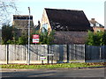
Converted farm buildings off Farmbrook Close
These are former buildings associated with Grove Farm and now converted to accommodation.
Image: © Chris Allen
Taken: 29 Dec 2014
0.11 miles
2
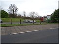
Land for development
Persimmon appear to have acquired this land and are already selling plots. The land is between Laugherne Brook and the Worcester to Hereford railway line.
Image: © Philip Halling
Taken: 14 Feb 2020
0.12 miles
3
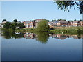
New houses on the edge of Worcester
Seen across a pond that the map describes as a reservoir.
Image: © Chris Allen
Taken: 13 Sep 2020
0.12 miles
4
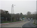
Bromyard Road approaching Broadway Grove
The eastern end of the 500 yard road widening scheme associated with greenfield housing development west of Tudor Way. The two sets of traffic lights are a bizarre solution to giving buses priority from the short section of bus lane. The second set of lights have hooded lenses making them invisible from the previous set a few yards beforehand and hence highly vulnerable to being passed at red when the previous set is green. Why dedicated lights for the bus lane were not provided (rather than the give way sign) is a bit of a mystery.
Image: © Peter Whatley
Taken: 14 Mar 2012
0.13 miles
5
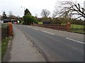
The A44 crossing Laugherne Brook
The A44 crossing Laugherne Brook in St John's on the western side of Worcester.
Image: © Philip Halling
Taken: 14 Feb 2020
0.13 miles
6
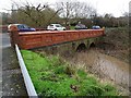
Bridge over Laugherne Brook
Bridge carrying the A44 over Laugherne Brook (pronounced Lawn) in St John's on the western side of Worcester.
Image: © Philip Halling
Taken: 14 Feb 2020
0.13 miles
7
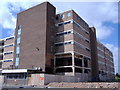
Kays Catalogue Warehouse
Kays catalogue warehouse-Bransford Road-Bransford Road side-right side
Image: © James Pratt
Taken: 21 Apr 2010
0.14 miles
8
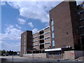
Kays Catalogue Warehouse
Kays catalogue warehouse-Bransford Road-Bransford Road side
Image: © James Pratt
Taken: 21 Apr 2010
0.14 miles
9
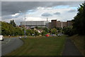
Bromyard Road, Worcester
The large building in the background is the former Kay's distribution warehouse and offices. The Kay's operation in Worcester has since closed and these buildings gone Image]
Image: © Philip Halling
Taken: 15 Sep 2005
0.15 miles
10
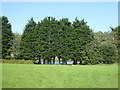
Grassland and reservoir on the edge of Worcester
Seen from a path alongside the railway line.
Image: © Chris Allen
Taken: 13 Sep 2020
0.15 miles