IMAGES TAKEN NEAR TO
Bromyard Road, WORCESTER, WR2 5TT
Introduction
This page details the photographs taken nearby to Bromyard Road, WR2 5TT by members of the Geograph project.
The Geograph project started in 2005 with the aim of publishing, organising and preserving representative images for every square kilometre of Great Britain, Ireland and the Isle of Man.

There are currently over 7.5m images from over14,400 individuals and you can help contribute to the project by visiting https://www.geograph.org.uk
Image Map
Images are licensed for reuse under creativecommons.org/licenses/by-sa/2.0
Notes
- Clicking on the map will re-center to the selected point.
- The higher the marker number, the further away the image location is from the centre of the postcode.
Image Listing (27 Images Found)
Images are licensed for reuse under creativecommons.org/licenses/by-sa/2.0
Image
Details
Distance
1
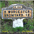
Old Milestone by the A44, Bromyard Road, Rushwick parish
Metal plate attached to concrete post by the A44, in parish of RUSHWICK (MALVERN HILLS District), Bromyard Road, South of Earls Court, on the verge, on South side of road. Bradley post, erected by the County Council in the 20th century.
Inscription reads:-
A44
2 WORCESTER.
BROMYARD 12.
C.C.W.
Milestone Society National ID: WO_WOBY02.
Image: © J Higgins
Taken: 1 May 2007
0.05 miles
2
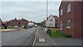
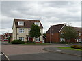
New houses on Baskerville Drive
This is the spine road for the "Regency Gate" development on Worcester's western outskirts.
Image: © Peter Whatley
Taken: 5 Sep 2024
0.05 miles
3
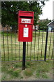
Elizabeth II postbox on Earls Court Way, Worcester
Postbox No. WR2 97.
Image: © JThomas
Taken: 11 Aug 2021
0.09 miles
4
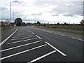
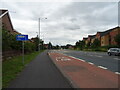
Bromyard Road, Worcester
With a new housing estate being built to the left Bromyard Road has been widdened
Image: © Philip Halling
Taken: 11 Oct 2011
0.10 miles
5
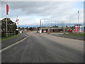
Entrance to housing development, Worcester
Entrance to a new housing development off Bromyard Road in Dines Green in Worcester.
Image: © Philip Halling
Taken: 11 Oct 2011
0.11 miles
8
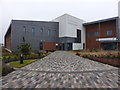
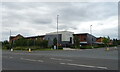
St John's House Medical Centre
This replaces the original centre in an old house near the centre of the St Johns suburb of Worcester. It is surrounded by a major new redevelopment that includes university buildings.
Image: © Chris Allen
Taken: 15 Feb 2015
0.12 miles
9
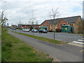
Juniper House - residential care home, Worcester
In new development at the edge of Worcester. The building to its left in the background is a health centre/surgery. I was heading there for my second Covid-19 vaccination.
Image: © Chris Allen
Taken: 16 Apr 2021
0.14 miles