IMAGES TAKEN NEAR TO
Baradene Lane, WORCESTER, WR2 5TL
Introduction
This page details the photographs taken nearby to Baradene Lane, WR2 5TL by members of the Geograph project.
The Geograph project started in 2005 with the aim of publishing, organising and preserving representative images for every square kilometre of Great Britain, Ireland and the Isle of Man.

There are currently over 7.5m images from over14,400 individuals and you can help contribute to the project by visiting https://www.geograph.org.uk
Image Map
Images are licensed for reuse under creativecommons.org/licenses/by-sa/2.0
Notes
- Clicking on the map will re-center to the selected point.
- The higher the marker number, the further away the image location is from the centre of the postcode.
Image Listing (48 Images Found)
Images are licensed for reuse under creativecommons.org/licenses/by-sa/2.0
Image
Details
Distance
2
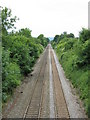
Rushwick - site of the railway halt
No traces remain more than 40 years after closure.
Image: © Peter Whatley
Taken: 12 Jun 2008
0.03 miles
4
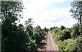
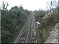
Rushwick Halt (Site Of)
Looking along the line to Malvern from the bridge close to the Whitehall pub. The section of railway from Henwick to Malvern link opened on the 25th July 1859. The Worcester and Hereford Railway became part of the West Midland Railway on 1st July 1861 and the G.W.R. on 1st August 1863. Rushwick Halt opened in 1924, but closed on 3rd April 1965.
Image: © Bob Embleton
Taken: 12 Aug 2007
0.05 miles
5
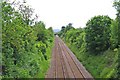
Railway at Rushwick
The railway in this direction goes to Great Malvern and Hereford. In the distance is a small bridge taking a minor lane across the railway. In the far distance part of the Malvern Hills can be glimpsed.
Image: © P L Chadwick
Taken: 15 May 2011
0.06 miles
6
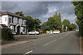
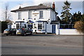
The Whitehall Inn, Rushwick
The Whitehall Inn in Rushwick. The road passing through the village is now much quieter after the construction of the Worcester Link road.
Image: © Philip Halling
Taken: 15 Sep 2005
0.06 miles
7
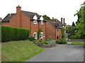
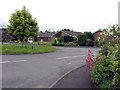
Rushwick - houses by the main junction
Image: © Peter Whatley
Taken: 12 Jun 2008
0.06 miles
8
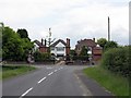
Rushwick - former major junction
The status of the former main A 4103 route through Rushwick village is given away by the 'primary route' green signs at the junction, despite deteriorated lettering.
Image: © Peter Whatley
Taken: 12 Jun 2008
0.07 miles
9
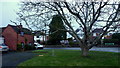
Rushwick, Worcestershire, 1
Looking across the old Hereford Road (was the A4103, as can still be seen on the signs) from Claphill Lane.
Image: © Jonathan Billinger
Taken: 16 Jan 2018
0.08 miles