
IMAGES TAKEN NEAR TO
Drake Avenue, WORCESTER, WR2 5RH
Introduction
This page details the photographs taken nearby to Drake Avenue, WR2 5RH by members of the Geograph project.
The Geograph project started in 2005 with the aim of publishing, organising and preserving representative images for every square kilometre of Great Britain, Ireland and the Isle of Man.

There are currently over 7.5m images from over14,400 individuals and you can help contribute to the project by visiting https://www.geograph.org.uk
Image Map
Images are licensed for reuse under creativecommons.org/licenses/by-sa/2.0
Notes
- Clicking on the map will re-center to the selected point.
- The higher the marker number, the further away the image location is from the centre of the postcode.
Image Listing (39 Images Found)
Images are licensed for reuse under creativecommons.org/licenses/by-sa/2.0
Image
Details
Distance
1
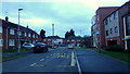
Drake Avenue, Dines Green
Western suburb of Worcester, dating back to the 1950's.
Image: © Jonathan Billinger
Taken: 17 Jan 2018
0.06 miles
2
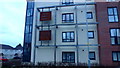
This is Dines Green
Signs showing some pride in the area, a suburb of Worcester, first established in 1954.
Image: © Jonathan Billinger
Taken: 17 Jan 2018
0.06 miles
4
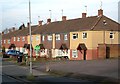
Houses In Tudor Way, Worcester
Viewed near the southern junction of Tudor Way and Drake Avenue.
Image: © Mary and Angus Hogg
Taken: 31 Jan 2009
0.07 miles
5
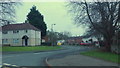
Raleigh Close, Dines Green, Worcester
1950's suburb of the city on a Friday afternoon in January 2018.
Image: © Jonathan Billinger
Taken: 12 Jan 2018
0.09 miles
6
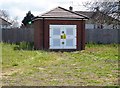
Electricity substation, near Kings Park, Worcester
Located near to the entrance to the Kings Park housing development, and presumably serves that and other recent housing in this area.
Image: © P L Chadwick
Taken: 30 Apr 2016
0.14 miles
7
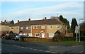
Houses In Tudor Way, Worcester
Viewed at the junction of Tudor Way and Grenville Road.
Image: © Mary and Angus Hogg
Taken: 31 Jan 2009
0.15 miles
8
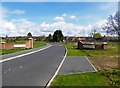
Entrance to Kings Park, Worcester
Kings Park is a recent housing development which is accessed from Bromyard Road (part of the A44) by a turning off called Earls Court Road. At the entrance to the estate are these walls both carrying large engraved stone plaques with the name "Kings Park".
Image: © P L Chadwick
Taken: 30 Apr 2016
0.15 miles
9
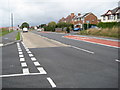
Bromyard Road, Worcester
Bromyard Road viewed from Meadowbank Drive. This park of Worcester is undergoing some change which new houses being built on the site in the background. The traffic lights are on the junction of Tudor Way.
Image: © Philip Halling
Taken: 11 Oct 2011
0.17 miles
10
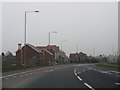
New housing development on Bromyard Road
A large greenfield site is being developed alongside Bromyard Road. A prominent part of the associated works has been road widening from west of Tudor Way to Broadway Grove, including a recessed right turn lane for traffic to access the new houses. The scheme has also introduced three new sets of traffic lights and a bus lane. As the scheme covers such a short distance, the additional delays from the extra sets of lights have extended the area of congestion, meaning slower journeys for all traffic, including the buses!
Image: © Peter Whatley
Taken: 14 Mar 2012
0.17 miles