IMAGES TAKEN NEAR TO
Ashford Road, WORCESTER, WR2 5FT
Introduction
This page details the photographs taken nearby to Ashford Road, WR2 5FT by members of the Geograph project.
The Geograph project started in 2005 with the aim of publishing, organising and preserving representative images for every square kilometre of Great Britain, Ireland and the Isle of Man.

There are currently over 7.5m images from over14,400 individuals and you can help contribute to the project by visiting https://www.geograph.org.uk
Image Map
Images are licensed for reuse under creativecommons.org/licenses/by-sa/2.0
Notes
- Clicking on the map will re-center to the selected point.
- The higher the marker number, the further away the image location is from the centre of the postcode.
Image Listing (36 Images Found)
Images are licensed for reuse under creativecommons.org/licenses/by-sa/2.0
Image
Details
Distance
1
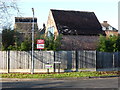
Converted farm buildings off Farmbrook Close
These are former buildings associated with Grove Farm and now converted to accommodation.
Image: © Chris Allen
Taken: 29 Dec 2014
0.06 miles
2
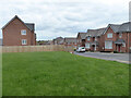
Ashford Road, Worcester
A new housing development - one of several in Worcester.
Image: © Chris Allen
Taken: 16 Apr 2021
0.07 miles
3
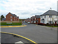
Ashford Road, Worcester
Seen from the junction with University Park Drive in this new development on the edge of Worcester.
Image: © Chris Allen
Taken: 16 Apr 2021
0.07 miles
4
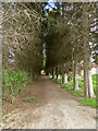
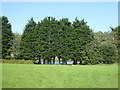
Tree-lined path between new developments
There are new housing developments to each side but they are well-screened in this view.
Image: © Chris Allen
Taken: 16 Apr 2021
0.07 miles
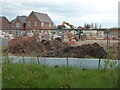
5
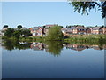
New houses on the edge of Worcester
Seen across a pond that the map describes as a reservoir.
Image: © Chris Allen
Taken: 13 Sep 2020
0.07 miles
6
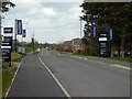
University Park Drive, Worcester
The new housing development by Bloor Homes is behind the photographer and this road leads to it.
Image: © Chris Allen
Taken: 16 Apr 2021
0.09 miles
7
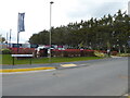
New housing development, Worcester
A Bloor Homes development by University Park Drive, Worcester. The building site along Ashford Road extends out of sight to the left.
Image: © Chris Allen
Taken: 16 Apr 2021
0.09 miles
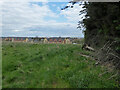
8
Grassland and reservoir on the edge of Worcester
Seen from a path alongside the railway line.
Image: © Chris Allen
Taken: 13 Sep 2020
0.12 miles
9
Across the field to University Park Drive
New development on the edge of Worcester.
Image: © Chris Allen
Taken: 16 Apr 2021
0.13 miles
10
New housing development, Worcester
This is on Ashford Road off University Park Drive.
Image: © Chris Allen
Taken: 16 Apr 2021
0.13 miles