
IMAGES TAKEN NEAR TO
Abbey Close, WORCESTER, WR2 4TW
Introduction
This page details the photographs taken nearby to Abbey Close, WR2 4TW by members of the Geograph project.
The Geograph project started in 2005 with the aim of publishing, organising and preserving representative images for every square kilometre of Great Britain, Ireland and the Isle of Man.

There are currently over 7.5m images from over14,400 individuals and you can help contribute to the project by visiting https://www.geograph.org.uk
Image Map
Images are licensed for reuse under creativecommons.org/licenses/by-sa/2.0
Notes
- Clicking on the map will re-center to the selected point.
- The higher the marker number, the further away the image location is from the centre of the postcode.
Image Listing (52 Images Found)
Images are licensed for reuse under creativecommons.org/licenses/by-sa/2.0
Image
Details
Distance
1

Bench mark on milestone
This milestone is a Grade II listed structure, and the depression on top is probably the remains of a "pivot" bench mark established in 1844 during the First primary levelling of England & Wales, which was levelled with a height of 60.1740 feet [18.3410 metres] above mean sea level (Liverpool datum). It was included on the Manchester to Gloucester levelling line. The surveyor's description was "No. 393. Mark on top of the 4th milestone from Worcester, and 6th from Upton-on-Severn ; 2.54 ft. above centre of road." (Public Abstract p.35)
Image: © Shantavira
Taken: 21 Jun 2014
0.03 miles
2

Old Milestone by the B4424, Upton Road, Stanbrook, Powick parish
Metal plate attached to stone post by the B4424, in parish of POWICK (MALVERN HILLS District), Stanbrook, opposite Abbey Close; Callow End, 100m South of shop, on bank behind path, in hedge, on East side of road. Worcester Cross iron plate, erected by the Worcester turnpike trust in the 19th century.
Inscription reads:-
(TO)
WOR(C)ESTER
CROSS
4
MILES
Grade II listed.
List Entry Number: 1167143 https://historicengland.org.uk/listing/the-list/list-entry/1167143
Milestone Society National ID: WO_WOUS04.
Image: © J Higgins
Taken: 1 May 2007
0.03 miles
3

Callow End - Milestone
Historic milestone in the village of Callow End, 4 miles from Worcester Cross.
Image: © Colin Smith
Taken: 12 Aug 2018
0.03 miles
4

Stanbrook Abbey Hotel
The Stanbrook Abbey community goes back to Cambrai in 17th century Flanders. The survivors of the French Revolution returned to England in 1795 and settling in 1838 at Callow End, Worcestershire. The community moved to Wass, North Yorkshire in 2009.
The site is now the upmarket Stanbrook Abbey Hotel and a conference centre.
www.stanbrookabbey.org.uk
Image: © Colin Smith
Taken: 12 Aug 2018
0.03 miles

6

Houses on Upton Road, Pole Elm, Worcestershire
Taken from junction with Lower Ferry Lane
Image: © Jeff Gogarty
Taken: 19 Dec 2015
0.04 miles
7

Stanbrook Abbey
The nuns are moving from here to anew place in North Yorkshire. In the foreground is the local "Pole Elm Garage"
Image: © Bob Embleton
Taken: 18 Nov 2005
0.04 miles
8
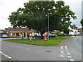
Callow End, village store and post office
A little village between Worcester and Upton-on-Severn. The store is a Premier store.
Image: © Chris Allen
Taken: 6 Sep 2020
0.05 miles

10

The B4424 passing through Callow End
The B4424 passing a pair of lodges to Stanbrook Abbey. The entrance to the abbey is at the other end of Callow End, hence the sign.
Image: © Philip Halling
Taken: 19 Apr 2018
0.05 miles