
IMAGES TAKEN NEAR TO
Hooper Close, WORCESTER, WR2 4TU
Introduction
This page details the photographs taken nearby to Hooper Close, WR2 4TU by members of the Geograph project.
The Geograph project started in 2005 with the aim of publishing, organising and preserving representative images for every square kilometre of Great Britain, Ireland and the Isle of Man.

There are currently over 7.5m images from over14,400 individuals and you can help contribute to the project by visiting https://www.geograph.org.uk
Image Map
Images are licensed for reuse under creativecommons.org/licenses/by-sa/2.0
Notes
- Clicking on the map will re-center to the selected point.
- The higher the marker number, the further away the image location is from the centre of the postcode.
Image Listing (33 Images Found)
Images are licensed for reuse under creativecommons.org/licenses/by-sa/2.0
Image
Details
Distance
1
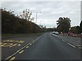
A449 and its former route in Powick
Formerly the A449 used the road to the right, which has now become a service road for the houses.
Image: © David Smith
Taken: 5 Nov 2011
0.08 miles
2
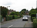
Powick - Winsmore
A set of council housing so dull the tarmac doesn't even have a suffix.
Image: © Peter Whatley
Taken: 12 Jun 2008
0.08 miles
3

Winsmore, Powick
Older council housing to the south of the village.
Image: © Jonathan Billinger
Taken: 18 May 2010
0.11 miles
4
A449 Malvern Road Leaving Powick Village
Image: © Roy Hughes
Taken: 20 Apr 2016
0.12 miles
5
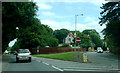
"One Way" junction at Powick
Although Malvern Road deviates to the right, through traffic (towards Worcester) continue straight ahead here.
Image: © Clint Mann
Taken: 18 Jul 2016
0.12 miles
6
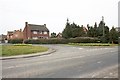
Old Rectory Close, Powick
Viewed from the Upton Road adorned with daffodils.
Image
Image: © Bob Embleton
Taken: 19 Mar 2010
0.12 miles
7
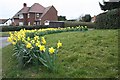
Daffodils, Rectory Close, Powick
At the junction of Rectory Close and the Upton Road.
Image
Many areas of the country are reporting a late spring with few daffodils blooming.
Worcestershire appears to be an exception.
Image: © Bob Embleton
Taken: 19 Mar 2010
0.13 miles
8

Upton Road, Powick
The B4424 looking north towards the village centre.
Image: © Jonathan Billinger
Taken: 18 May 2010
0.13 miles
9
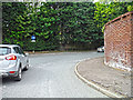
Powick : Malvern Road
Looking towards Malvern Road at the junction with Upton Road.
Image: © Lewis Clarke
Taken: 5 May 2014
0.15 miles
10
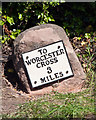
Old Milestone by the B4424, Upton Road, south of Powick
Metal plate attached to stone post by the B4424, in parish of Powick (Malvern Hills District), Upton Road, opposite No. 63; South of Manor Farm; ¼ mile South of Powick Church, in hedge, on East side of road. Erected by the Worcester turnpike trust in the 19th century.
Inscription reads:-
TO
WORCESTER
CROSS
3
MILES
Pivot benchmark on top.
Grade II listed.
List Entry Number: 1098755 https://historicengland.org.uk/listing/the-list/list-entry/1098755
Milestone Society National ID: WO_WOUS03
Image: © J Higgins
Taken: 1 May 2007
0.15 miles