
IMAGES TAKEN NEAR TO
Upper Ferry Lane, WORCESTER, WR2 4TL
Introduction
This page details the photographs taken nearby to Upper Ferry Lane, WR2 4TL by members of the Geograph project.
The Geograph project started in 2005 with the aim of publishing, organising and preserving representative images for every square kilometre of Great Britain, Ireland and the Isle of Man.

There are currently over 7.5m images from over14,400 individuals and you can help contribute to the project by visiting https://www.geograph.org.uk
Image Map
Images are licensed for reuse under creativecommons.org/licenses/by-sa/2.0
Notes
- Clicking on the map will re-center to the selected point.
- The higher the marker number, the further away the image location is from the centre of the postcode.
Image Listing (24 Images Found)
Images are licensed for reuse under creativecommons.org/licenses/by-sa/2.0
Image
Details
Distance
1
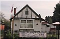
Callow End Club
The club is adjacent to, and on the south side of, St James church.
Image: © Angus McCulloch
Taken: 17 Mar 2009
0.10 miles
2
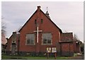
St James Callow End
St James, a daughter church of St Peter Powick, is situated between the village school and Callow End Club.
Image: © Angus McCulloch
Taken: 17 Mar 2009
0.12 miles
3
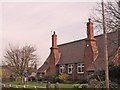
Callow End Village School
Callow End Church of England Primary School is located on the east side of Upton Road, north of St James church.
Image: © Angus McCulloch
Taken: 17 Mar 2009
0.13 miles
4
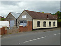
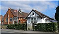
Stonemasons and sculptors workshop, Callow End
A nice little workshop next to the B-road through this Worcestershire village.
Image: © Chris Allen
Taken: 6 Sep 2020
0.14 miles
7
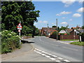
Callow End - view toward the Church
Callow End Club is the white building in front of the church where the road bends in the distance.
Image: © Peter Whatley
Taken: 10 Jun 2008
0.15 miles
8

Callow End
View along the B4424 from near the turn to The Old Bush public house. On the right is a stonemasons yard. The white building in the background is the social club and beyond that is a church.
Image: © Chris Allen
Taken: 6 Sep 2020
0.15 miles
9
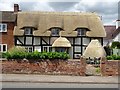
Recently thatched cottage in Callow End
The timber-framed thatched cottage on Upton Road in Callow End has recently been rethatched, including the well in the garden. The cottage is Grade II listed, see: https://historicengland.org.uk/listing/the-list/list-entry/1167134
Image: © Philip Halling
Taken: 17 Jul 2020
0.15 miles
10
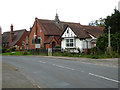
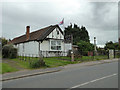
Callow end Social Club, church and school
Three key elements of village life clustered together with the war memorial alongside.
Image: © Chris Allen
Taken: 6 Sep 2020
0.15 miles