
IMAGES TAKEN NEAR TO
Sparrowhall Lane, WORCESTER, WR2 4SG
Introduction
This page details the photographs taken nearby to Sparrowhall Lane, WR2 4SG by members of the Geograph project.
The Geograph project started in 2005 with the aim of publishing, organising and preserving representative images for every square kilometre of Great Britain, Ireland and the Isle of Man.

There are currently over 7.5m images from over14,400 individuals and you can help contribute to the project by visiting https://www.geograph.org.uk
Image Map
Images are licensed for reuse under creativecommons.org/licenses/by-sa/2.0
Notes
- Clicking on the map will re-center to the selected point.
- The higher the marker number, the further away the image location is from the centre of the postcode.
Image Listing (15 Images Found)
Images are licensed for reuse under creativecommons.org/licenses/by-sa/2.0
Image
Details
Distance
1
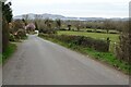
Sparrowhall Lane
Sparrowhall Lane at Bowling Green. The Malvern Hills are on the horizon.
Image: © Philip Halling
Taken: 17 Mar 2021
0.02 miles
2
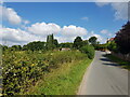
Sparrowhall Lane, Collett's Green, Worcestershire
Image: © Jeff Gogarty
Taken: 28 Aug 2021
0.03 miles
3
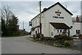
The Three Nuns Inn
The Three Nuns public house in Bowling Green. The pub is currently closed during the COVID-19 third lockdown.
Image: © Philip Halling
Taken: 17 Mar 2021
0.09 miles
4
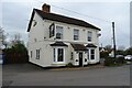
The Three Nuns Inn
The Three Nuns public house in Bowling Green. The pub is currently closed during the COVID-19 third lockdown.
Image: © Philip Halling
Taken: 17 Mar 2021
0.09 miles
5
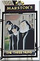
The Three Nuns
The Three Nuns inn sign at Bowling Green Image
Image: © Philip Halling
Taken: 17 Mar 2021
0.09 miles
6
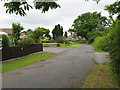
Bowling Green Road
The southern end of what is now a dead-end lane.
Image: © Peter Whatley
Taken: 12 Jun 2008
0.11 miles
7
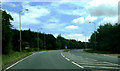
Junctions and bend on A449
Road to left (Sparrowhall Lane) leads to Collett's Green.
Image: © Clint Mann
Taken: 18 Jul 2016
0.12 miles
9
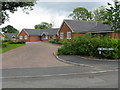
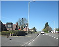
Bowling Green - The Parklands
A new group of bungalows on what used to be a piece of open ground.
Image: © Peter Whatley
Taken: 12 Jun 2008
0.14 miles
10
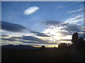
Sunset at the Crown
View south-west from the Crown public house. The Malverns in the distance on the left.
Image: © Trevor Rickard
Taken: 10 Oct 2008
0.17 miles