IMAGES TAKEN NEAR TO
Kyre, TENBURY WELLS, WR15 8QD
Introduction
This page details the photographs taken nearby to WR15 8QD by members of the Geograph project.
The Geograph project started in 2005 with the aim of publishing, organising and preserving representative images for every square kilometre of Great Britain, Ireland and the Isle of Man.

There are currently over 7.5m images from over14,400 individuals and you can help contribute to the project by visiting https://www.geograph.org.uk
Image Map (Loading...)


Getting Data...Please wait
Leaflet Map data © OpenStreetMap
Images are licensed for reuse under creativecommons.org/licenses/by-sa/2.0
Notes
- Clicking on the map will re-center to the selected point.
- The higher the marker number, the further away the image location is from the centre of the postcode.
Image Listing (9 Images Found)
Images are licensed for reuse under creativecommons.org/licenses/by-sa/2.0
Image
Details
Distance
1
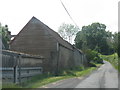
Buildings of Bank Farm
Looking from the end of the drive to Pigeon House Farm.
Image: © Bob Embleton
Taken: 1 Jul 2007
0.03 miles
2
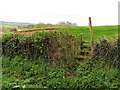
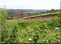
Stile, Gatehouse Farm
You are rarely far from a footpath in Worcestershire and nowadays most have stiles. Grassland on slopes near Kyre.
Image: © Richard Webb
Taken: 1 May 2010
0.10 miles
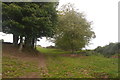
3
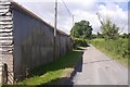
Passing Gatehouse Farm
Climbing out of Kyre.
Image: © Richard Webb
Taken: 4 Aug 2016
0.13 miles
4
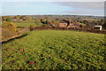
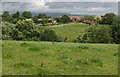
Gatehouse Farm, Kyre
Gatehouse Farm at Kyre, pictured from a footpath to the west.
Image: © Philip Halling
Taken: 30 Nov 2013
0.13 miles
6
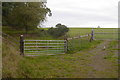
Gatehouse Farm
Taken (eventually) from the very overgrown public footpath stile.
Image: © Bob Embleton
Taken: 1 Jul 2007
0.16 miles
7
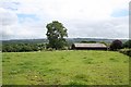
Pigeon House Farm
Viewed from the end of the drive. With the grey whale of Titterstone Clee in the distance.
Image: © Bob Embleton
Taken: 1 Jul 2007
0.17 miles
9
Path, Pigeon House
Obviously a well used route once.
Image: © Richard Webb
Taken: 8 Oct 2017
0.24 miles