
IMAGES TAKEN NEAR TO
Pembroke Court, TENBURY WELLS, WR15 8PF
Introduction
This page details the photographs taken nearby to Pembroke Court, WR15 8PF by members of the Geograph project.
The Geograph project started in 2005 with the aim of publishing, organising and preserving representative images for every square kilometre of Great Britain, Ireland and the Isle of Man.

There are currently over 7.5m images from over14,400 individuals and you can help contribute to the project by visiting https://www.geograph.org.uk
Image Map
Images are licensed for reuse under creativecommons.org/licenses/by-sa/2.0
Notes
- Clicking on the map will re-center to the selected point.
- The higher the marker number, the further away the image location is from the centre of the postcode.
Image Listing (398 Images Found)
Images are licensed for reuse under creativecommons.org/licenses/by-sa/2.0
Image
Details
Distance
1
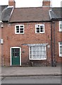
Old Toll House, Cross Street, Tenbury Wells
Toll House by the A4112, in the parish of Tenbury, The Old Toll House, 19 Cross Street, Tenbury Wells.
Surveyed
Milestone Society National ID: WO.TEN
Image: © Milestone Society
Taken: Unknown
0.02 miles
2
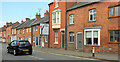
Terraced houses, Tenbury Wells
Looking the other way along Cross Street from Image
Image: © Derek Harper
Taken: 15 Jul 2021
0.03 miles
4
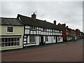
1 and 3 Cross Street, Tenbury Wells
Date from about 1600 https://historicengland.org.uk/listing/the-list/list-entry/1082427?section=official-list-entry
Image: © Jonathan Thacker
Taken: 23 Aug 2022
0.04 miles
5
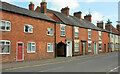
Terraced houses, Tenbury Wells
On Cross Street, the A4112, from the junction with Berrington Road.
Image: © Derek Harper
Taken: 15 Jul 2021
0.04 miles
6
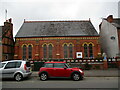
Tenbury Cornerstone
Based in Tenbury Methodist church. The building dates from 1893-4.
Image: © Jonathan Thacker
Taken: 23 Aug 2022
0.04 miles
7
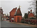
Oast House Toilets (Tenbury Wells)
Weirdest oast houses I have ever seen... wait, they just house toilets? Oh wow! These were built around 2007 after the disastrous flood hit Tenbury Wells.
Image: © Fabian Musto
Taken: 10 Apr 2018
0.04 miles
8
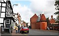
Market Street, Tenbury Wells
The Royal Oak Hotel is on the left.
On the right are the new toilets after the old ones had been damaged by the stream (just to the right of the wall) flooding.
Compare with the September 2009 photo:-
Image]
Image: © Bob Embleton
Taken: 16 Oct 2010
0.04 miles
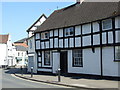
10
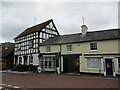
Market Square, Tenbury Wells, east side
On the left 16 and 17 dating to the seventeenth century https://historicengland.org.uk/listing/the-list/list-entry/1180011?section=official-list-entry On the right 18 and 18 dating from the early nineteenth century https://historicengland.org.uk/listing/the-list/list-entry/1180016?section=official-list-entry
Image: © Jonathan Thacker
Taken: 23 Aug 2022
0.04 miles