IMAGES TAKEN NEAR TO
Clee Hill Road, TENBURY WELLS, WR15 8HL
Introduction
This page details the photographs taken nearby to Clee Hill Road, WR15 8HL by members of the Geograph project.
The Geograph project started in 2005 with the aim of publishing, organising and preserving representative images for every square kilometre of Great Britain, Ireland and the Isle of Man.

There are currently over 7.5m images from over14,400 individuals and you can help contribute to the project by visiting https://www.geograph.org.uk
Image Map
Images are licensed for reuse under creativecommons.org/licenses/by-sa/2.0
Notes
- Clicking on the map will re-center to the selected point.
- The higher the marker number, the further away the image location is from the centre of the postcode.
Image Listing (9 Images Found)
Images are licensed for reuse under creativecommons.org/licenses/by-sa/2.0
Image
Details
Distance
2
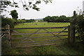
Gate into a field off Clee Hill Road
Gate into a field off Clee Hill Road; a footpath also crossed this field.
Image: © Philip Halling
Taken: 30 Jul 2011
0.03 miles
3
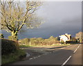
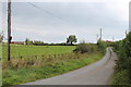
Turning for Harthall, on Clee Hill Road
Image: © Roger Cornfoot
Taken: 26 Dec 2011
0.04 miles
5
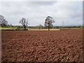
Rugpits
Ploughed field, view SW. Pylons, probably made locally in Hereford carry electricity to Ludlow and beyond.
Image: © Richard Webb
Taken: 1 Apr 2006
0.13 miles
8
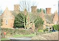
Elaborate terrace
With their ornamental gable ends and substantial chimneys, these cottages dating from 1859 are quite striking.
Image: © David Luther Thomas
Taken: 20 Jan 2007
0.19 miles