
IMAGES TAKEN NEAR TO
Croft Bank, MALVERN, WR14 4DU
Introduction
This page details the photographs taken nearby to Croft Bank, WR14 4DU by members of the Geograph project.
The Geograph project started in 2005 with the aim of publishing, organising and preserving representative images for every square kilometre of Great Britain, Ireland and the Isle of Man.

There are currently over 7.5m images from over14,400 individuals and you can help contribute to the project by visiting https://www.geograph.org.uk
Image Map
Images are licensed for reuse under creativecommons.org/licenses/by-sa/2.0
Notes
- Clicking on the map will re-center to the selected point.
- The higher the marker number, the further away the image location is from the centre of the postcode.
Image Listing (84 Images Found)
Images are licensed for reuse under creativecommons.org/licenses/by-sa/2.0
Image
Details
Distance
1
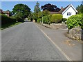
Mathon Road, West Malvern
Steep road with some housing on the lower western slopes of the Malvern Hills.
Image: © Philip Halling
Taken: 5 Jun 2016
0.01 miles
2
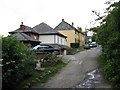
West Malvern - Montpelier Road
View from the footpath at the southern end of the road.
Image: © Peter Whatley
Taken: 10 Jun 2008
0.08 miles
3
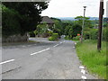
Steeper than 1 in 8
Croft Bank, West Malvern, looking down from the junction with Croft Farm Drive. According to the OS 1:50k map, the slope is between 1 in 5 and 1 in 7. It certainly felt like it.
Image: © Peter Whatley
Taken: 10 Jun 2008
0.11 miles
4
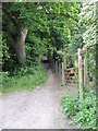
Through the woods
Footpath signs at the end of Montpelier Road, West Malvern.
Image: © Peter Whatley
Taken: 10 Jun 2008
0.12 miles
5
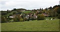
Runnings Park, West Malvern
Built as a model farm for Lady Howard de Walden who lived in the nearby mansion.
It has since been a hotel, a healing centre and converted to private housing.
http://www.mindbodyandsoultherapycentre.co.uk/
Image: © Bob Embleton
Taken: 21 Oct 2010
0.12 miles
6
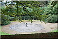
Octagon, Elim Conference Centre
A base for a statue? A bird bath? A sundial?
In the grounds of the conference centre, originally the gardens of Lady Howard de Walden's mansion, but for much of the 20th century, St James' girls school.
Image: © Bob Embleton
Taken: 21 Oct 2010
0.12 miles

8
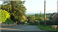
Croft Bank
From the Wyche Way at the junction with Croft Farm Drive. On the left is the turn into Montpelier Road.
Image: © Derek Harper
Taken: 13 Jul 2021
0.12 miles
9

St James and The Abbey School
With its spectacular views over Herefordshire and out to the Black Mountains this mansion of Lady Howard de Walden became a public boarding school for girls in 1902.
Image: © Bob Embleton
Taken: 30 Jun 2006
0.14 miles
10
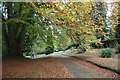
Track in autumn
The track runs through the beautiful grounds of the Elim conference Centre.
This used to be the gardens of the mansion where Lady Howard de Walden lived.
Later it became the public school of St James.
Image: © Bob Embleton
Taken: 21 Oct 2010
0.14 miles