IMAGES TAKEN NEAR TO
Brookfarm Drive, MALVERN, WR14 3SH
Introduction
This page details the photographs taken nearby to Brookfarm Drive, WR14 3SH by members of the Geograph project.
The Geograph project started in 2005 with the aim of publishing, organising and preserving representative images for every square kilometre of Great Britain, Ireland and the Isle of Man.

There are currently over 7.5m images from over14,400 individuals and you can help contribute to the project by visiting https://www.geograph.org.uk
Image Map
Images are licensed for reuse under creativecommons.org/licenses/by-sa/2.0
Notes
- Clicking on the map will re-center to the selected point.
- The higher the marker number, the further away the image location is from the centre of the postcode.
Image Listing (135 Images Found)
Images are licensed for reuse under creativecommons.org/licenses/by-sa/2.0
Image
Details
Distance
1
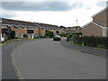
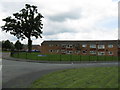
Malvern - Brook Farm Drive
Part of the Poolbrook council estate.
Image: © Peter Whatley
Taken: 6 Jun 2008
0.01 miles
2
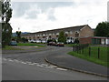
Malvern - Coniston Close
Part of the Poolbrook council estate.
Image: © Peter Whatley
Taken: 6 Jun 2008
0.05 miles
3
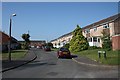
Coniston Close, Poolbrook, Malvern
Terraced housing between Poolbrook Common and Brook Farm Drive.
Image: © Bob Embleton
Taken: 29 May 2009
0.05 miles
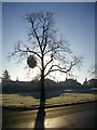
4

View west from Brook Farm Drive
The suburban road leading off here is Bredon Grove, with the Worcestershire Beacon (425m) in the distance.
Image: © Jonathan Billinger
Taken: 20 Oct 2008
0.05 miles
5
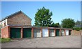
Garages off Coniston Close, Malvern
Providing somewhere to park a car securely on a housing estate with terraced housing.
Image: © Bob Embleton
Taken: 29 May 2009
0.06 miles
6
Malvern - access to Clover Way and Meadowsweet Close
Fragrant names for the Poolbrook council estate.
Image: © Peter Whatley
Taken: 6 Jun 2008
0.07 miles
7
Mistletoe, Poolbrook Common
Now that the leaves have gone the spheroids of mistletoe are obvious.
Image: © Bob Embleton
Taken: 7 Dec 2008
0.08 miles
8
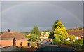
Poolbrook housing estate
The houses of Bredon Grove.
Many bungalows built on what had been allotments since the opening of the nearby Foley Institute in 1888.
Image: © Bob Embleton
Taken: 17 May 2009
0.09 miles
9
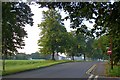
Poolbrook Road, Malvern
Cutting across Poolbrook Common
Image: © Bob Embleton
Taken: 28 Sep 2008
0.09 miles
10
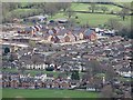
New housing development
New housing development at Poolbrook viewed here from the Malvern Hills.
Image: © Philip Halling
Taken: 18 Mar 2019
0.09 miles