
IMAGES TAKEN NEAR TO
Albert Park Road, MALVERN, WR14 1GT
Introduction
This page details the photographs taken nearby to Albert Park Road, WR14 1GT by members of the Geograph project.
The Geograph project started in 2005 with the aim of publishing, organising and preserving representative images for every square kilometre of Great Britain, Ireland and the Isle of Man.

There are currently over 7.5m images from over14,400 individuals and you can help contribute to the project by visiting https://www.geograph.org.uk
Image Map
Images are licensed for reuse under creativecommons.org/licenses/by-sa/2.0
Notes
- Clicking on the map will re-center to the selected point.
- The higher the marker number, the further away the image location is from the centre of the postcode.
Image Listing (217 Images Found)
Images are licensed for reuse under creativecommons.org/licenses/by-sa/2.0
Image
Details
Distance
2
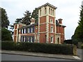
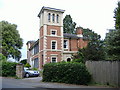
House on Albert Park Road
House with an Italianate appearance on Albert Park Road in Great Malvern.
Image: © Philip Halling
Taken: 27 Feb 2016
0.03 miles
3
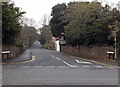
Albert Park Road, Malvern
Viewed across the A449 Worcester Road.
Image: © Jaggery
Taken: 29 Nov 2014
0.04 miles
4
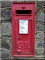
Georgian letterbox, Somers Road
George V letterbox on Somers Road in Great Malvern.
Image: © Philip Halling
Taken: 27 Feb 2016
0.07 miles
5
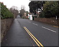
End of the no parking area at the southern end of Albert Park Road, Malvern
Double yellow lines make parking illegal near the corner of the A449 Worcester Road. http://www.geograph.org.uk/photo/4276092
Image: © Jaggery
Taken: 29 Nov 2014
0.07 miles
6
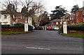
Entrance to Morgan Court, Malvern Link
Retirement/sheltered housing on the north side of Worcester Road.
Image: © Jaggery
Taken: 29 Nov 2014
0.08 miles
7
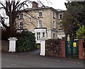
Morgan Court electricity substation, Malvern Link
The identifier on the Western Power Distribution electricity substation alongside Worcester Road is
MORGAN COURT S/S 33704.
Image: © Jaggery
Taken: 29 Nov 2014
0.08 miles
10

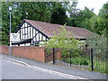
Ordnance Survey Bench Mark
This mark is located on a wall that borders Worcester Rd, in Malvern. These marks were used by Ordnance Survey for mapping purposes. Image
Image: © V1ncenze
Taken: 3 Nov 2020
0.08 miles