
IMAGES TAKEN NEAR TO
Brookfield, MALVERN, WR14 1DW
Introduction
This page details the photographs taken nearby to Brookfield, WR14 1DW by members of the Geograph project.
The Geograph project started in 2005 with the aim of publishing, organising and preserving representative images for every square kilometre of Great Britain, Ireland and the Isle of Man.

There are currently over 7.5m images from over14,400 individuals and you can help contribute to the project by visiting https://www.geograph.org.uk
Image Map
Images are licensed for reuse under creativecommons.org/licenses/by-sa/2.0
Notes
- Clicking on the map will re-center to the selected point.
- The higher the marker number, the further away the image location is from the centre of the postcode.
Image Listing (14 Images Found)
Images are licensed for reuse under creativecommons.org/licenses/by-sa/2.0
Image
Details
Distance
1
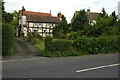
Half-timbered cottage, Malvern Link
A half-timbered cottage on Lower Howsell Road in Malvern Link.
Image: © Philip Halling
Taken: 2 Aug 2009
0.05 miles
2
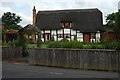
Thatched Cottage, Malvern Link
An attractive thatched Cottage on Lower Howsell Road in Malvern Link.
Image: © Philip Halling
Taken: 2 Aug 2009
0.05 miles
3
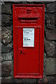
Victorian post box, Lower Howsell Road
A Victorian postbox near the New Inn on Lower Howsell Road. Over more than a century this post box appears to have had numerous coats of paint.
Image: © Philip Halling
Taken: 2 Aug 2009
0.07 miles
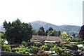
5
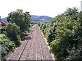
Worcester to Hereford railway from Lower Howsell Road bridge
Heading SW towards North Hill on the Malverns
Image: © Bob Embleton
Taken: 6 Aug 2005
0.09 miles
6
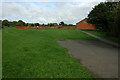
Playing field, Lower Howsell
A playing field and children's play area off Lower Howsell Road.
Image: © Philip Halling
Taken: 2 Aug 2009
0.09 miles
7
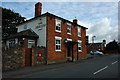
New Inn, Malvern Link
The New Inn on Lower Howsell Road in Malvern Link.
Image: © Philip Halling
Taken: 2 Aug 2009
0.09 miles
8
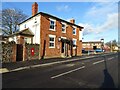
New Inn
The New Inn at Lower Howsell on Lower Howsell Road on the north edge of the conurbation in Malvern.
Image: © Philip Halling
Taken: 12 Dec 2020
0.13 miles
9
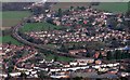
Bend in the Malvern to Worcester Railway Line
Viewed from North Hill we can see several developments in the sprawl of North Malvern.
The late 1940s social housing of Jamaica Road is on the left hand side of the track whilst the 1970s private housing estate of Oak Road lies on the right.
The white rendered houses are older (1930s) line Somers Park Avenue.
Image: © Bob Embleton
Taken: 26 Jan 2008
0.16 miles
10
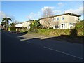
Prefab houses on Lower Howsell Road
Post-war prefab houses on Lower Howsell Road in Malvern.
Image: © Philip Halling
Taken: 12 Dec 2020
0.17 miles