
IMAGES TAKEN NEAR TO
Lower Howsell Road, MALVERN, WR14 1DL
Introduction
This page details the photographs taken nearby to Lower Howsell Road, WR14 1DL by members of the Geograph project.
The Geograph project started in 2005 with the aim of publishing, organising and preserving representative images for every square kilometre of Great Britain, Ireland and the Isle of Man.

There are currently over 7.5m images from over14,400 individuals and you can help contribute to the project by visiting https://www.geograph.org.uk
Image Map
Images are licensed for reuse under creativecommons.org/licenses/by-sa/2.0
Notes
- Clicking on the map will re-center to the selected point.
- The higher the marker number, the further away the image location is from the centre of the postcode.
Image Listing (19 Images Found)
Images are licensed for reuse under creativecommons.org/licenses/by-sa/2.0
Image
Details
Distance
1
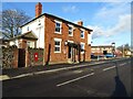
New Inn
The New Inn at Lower Howsell on Lower Howsell Road on the north edge of the conurbation in Malvern.
Image: © Philip Halling
Taken: 12 Dec 2020
0.06 miles
2
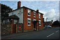
New Inn, Malvern Link
The New Inn on Lower Howsell Road in Malvern Link.
Image: © Philip Halling
Taken: 2 Aug 2009
0.09 miles
3
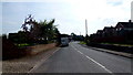
Lower Howsell Road
Looking south towards Malvern by Elm Farm.
Image: © Jonathan Billinger
Taken: 29 Sep 2015
0.10 miles
4
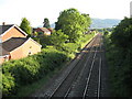
Worcester to Hereford railway line
Worcester to Hereford railway line at Lower Howsell where it approaches Malvern.
Image: © Philip Halling
Taken: 15 Jun 2010
0.11 miles
5
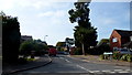
The Howsells
Cul-de-sac at the northern limit of the Malvern conurbation.
Image: © Jonathan Billinger
Taken: 29 Sep 2015
0.12 miles
6
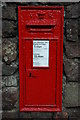
Victorian post box, Lower Howsell Road
A Victorian postbox near the New Inn on Lower Howsell Road. Over more than a century this post box appears to have had numerous coats of paint.
Image: © Philip Halling
Taken: 2 Aug 2009
0.13 miles
7
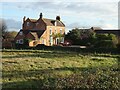
Elms Farmhouse
Elms Farmhouse viewed from Lower Howsell Lane. A fine Grade II listed https://historicengland.org.uk/listing/the-list/list-entry/1156609 18th century farmhouse on Lower Howsell Road between Malvern Link and Leigh Sinton. It no longer appears to be a working farm.
Image: © Philip Halling
Taken: 12 Dec 2020
0.14 miles
8
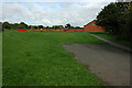
Playing field, Lower Howsell
A playing field and children's play area off Lower Howsell Road.
Image: © Philip Halling
Taken: 2 Aug 2009
0.15 miles
9
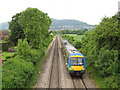
Malvern Link - train at Lower Howsell Road bridge 2008
Train heading toward Worcester, but don't bother trying to read the destination blind: it was displaying random dots! Unit 170505.
Image: © Peter Whatley
Taken: 27 May 2008
0.15 miles
10
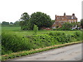
Malvern Link - Elms Farm 2008
One of several older buildings off Lower Howsell Road: a part of Malvern well worth exploring, but seldom visited by tourists.
Image: © Peter Whatley
Taken: 27 May 2008
0.17 miles