IMAGES TAKEN NEAR TO
Moreton Place, WORCESTER, WR1 3LZ
Introduction
This page details the photographs taken nearby to Moreton Place, WR1 3LZ by members of the Geograph project.
The Geograph project started in 2005 with the aim of publishing, organising and preserving representative images for every square kilometre of Great Britain, Ireland and the Isle of Man.

There are currently over 7.5m images from over14,400 individuals and you can help contribute to the project by visiting https://www.geograph.org.uk
Image Map (Loading...)


Getting Data...Please wait
Leaflet Map data © OpenStreetMap
Images are licensed for reuse under creativecommons.org/licenses/by-sa/2.0
Notes
- Clicking on the map will re-center to the selected point.
- The higher the marker number, the further away the image location is from the centre of the postcode.
Image Listing (2416 Images Found)
Images are licensed for reuse under creativecommons.org/licenses/by-sa/2.0
Image
Details
Distance
1
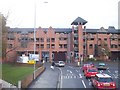
New Apartments
Squeezed in on the site of the old bus station between All Saints Road (straight ahead) and Newport Street (diagonally to the left).
Image: © Bob Embleton
Taken: 21 Feb 2009
0.01 miles
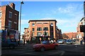
2
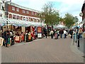
Angel Place, Worcester
The outdoor market area was made into its current form in the early 1990's. It forms part of the Crowngate Shopping Centre and Bus Station.
Image: © Derek Bradley
Taken: 18 May 2007
0.01 miles
3
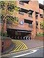
Entrance to Crowngate Car Park
Entrance to Crowngate Car Park of Dolday in Worcester.
Image: © Philip Halling
Taken: 11 Nov 2015
0.01 miles
4
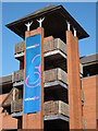
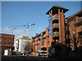
Stair tower on a multi-storey car park
The stair tower to the Crowngate multi-storey car park in Worcester.
Image: © Philip Halling
Taken: 4 Mar 2011
0.01 miles
5
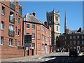
Dolday, Worcester
At the top of this street is the tower of All Saints church, and beyond the spire of St Andrews, the rest of this church was demolished in the 1940s.
Image: © Philip Halling
Taken: 30 Jun 2015
0.02 miles
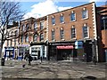
6
Businesses on Broad Street
Shops and restaurants on the east end of Broad Street where it meets Deansway.
Image: © Philip Halling
Taken: 5 Nov 2012
0.02 miles
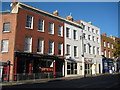
7
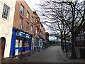
Shops and buildings, Broad Street
Shops and buildings on the western end of Broad Street in Worcester.
Image: © Philip Halling
Taken: 7 Mar 2016
0.02 miles
8
Crowngate multi-storey car park
The Crowngate multi-storey car park with Virginia House on the left and Worcester's new library under construction in the background. Viewed from All Saints Road.
Image: © Philip Halling
Taken: 4 Mar 2011
0.02 miles
9
CrownGate Multi-storey car park
Part of the CrownGate shopping centre. 1990s replacement for the 1960s Blackfriars shopping complex. The car park is an award winner according to:
http://www.crowngate-worcester.co.uk/crowngate_transport.htm
Image: © Bob Embleton
Taken: 3 Dec 2005
0.02 miles