
IMAGES TAKEN NEAR TO
The Winnings, Walwyn Road, MALVERN, WR13 6QB
Introduction
This page details the photographs taken nearby to The Winnings, Walwyn Road, WR13 6QB by members of the Geograph project.
The Geograph project started in 2005 with the aim of publishing, organising and preserving representative images for every square kilometre of Great Britain, Ireland and the Isle of Man.

There are currently over 7.5m images from over14,400 individuals and you can help contribute to the project by visiting https://www.geograph.org.uk
Image Map
Images are licensed for reuse under creativecommons.org/licenses/by-sa/2.0
Notes
- Clicking on the map will re-center to the selected point.
- The higher the marker number, the further away the image location is from the centre of the postcode.
Image Listing (73 Images Found)
Images are licensed for reuse under creativecommons.org/licenses/by-sa/2.0
Image
Details
Distance
1
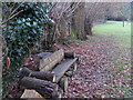
Rest-a-while
Rustic seat in grounds of Downs School,alongside public path.
Image: © Liz Stone
Taken: 22 Feb 2011
0.06 miles
2
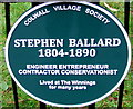
Stephen Ballard plaque, The Winnings, Colwall
Located here. http://www.geograph.org.uk/photo/4801084 The Colwall Village Society plaque records that Stephen Ballard 1804-1890, engineer, entrepreneur, contractor, conservationist, lived at The Winnings for many years.
Image: © Jaggery
Taken: 11 Jan 2016
0.06 miles
3
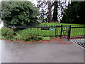
The Winnings fence and plaque, Colwall
This is one of two entrances to The Winnings from the B4218 Walwyn Road.
http://www.geograph.org.uk/photo/4801082 to a closer view of the plaque.
Image: © Jaggery
Taken: 11 Jan 2016
0.06 miles
4
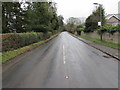
Ascent into the Malverns, Colwall
In the east of Herefordshire, the B4218 ascends away from Colwall towards Worcestershire.
The county boundary is little more than a kilometre ahead.
The bus stop on the right is for buses towards Ledbury.
Image: © Jaggery
Taken: 11 Jan 2016
0.07 miles
5
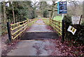
Vehicles to Hunters Lodge only, Colwall
50 metres east of the B4218, a grid crosses the access road to Hunters Lodge.
Walkers and horse riders can use the gate on the left.
Image: © Jaggery
Taken: 11 Jan 2016
0.08 miles
6
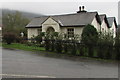
Recently widened single-storey house, Colwall
Viewed across the B4218 Walwyn Road in January 2016.
The house had two inverted V sections, not three, in a May 2011 Google Earth Street View.
Image: © Jaggery
Taken: 11 Jan 2016
0.08 miles
7
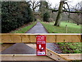
Your dog can KILL livestock - please keep it on a LEAD, Colwall
On the gate behind the grid here. http://www.geograph.org.uk/photo/4801220
Image: © Jaggery
Taken: 11 Jan 2016
0.08 miles
8
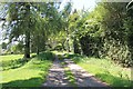
Old driveway, Colwall
Now a public footpath through the Ballard estate.
Image: © Bob Embleton
Taken: 26 May 2012
0.09 miles
9
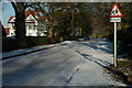
Brockhill Road, Colwall
A very icy Brockhill Road near a school in Colwall.
Image: © Philip Halling
Taken: 22 Dec 2009
0.09 miles
10

Walwyn Road, Colwall, Malvern, Worcestershire (uphill)
Image: © Jeff Gogarty
Taken: 6 Oct 2015
0.09 miles