IMAGES TAKEN NEAR TO
Drake Street, MALVERN, WR13 6LP
Introduction
This page details the photographs taken nearby to Drake Street, WR13 6LP by members of the Geograph project.
The Geograph project started in 2005 with the aim of publishing, organising and preserving representative images for every square kilometre of Great Britain, Ireland and the Isle of Man.

There are currently over 7.5m images from over14,400 individuals and you can help contribute to the project by visiting https://www.geograph.org.uk
Image Map
Images are licensed for reuse under creativecommons.org/licenses/by-sa/2.0
Notes
- Clicking on the map will re-center to the selected point.
- The higher the marker number, the further away the image location is from the centre of the postcode.
Image Listing (162 Images Found)
Images are licensed for reuse under creativecommons.org/licenses/by-sa/2.0
Image
Details
Distance
1
Drake Street, Welland
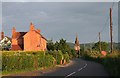
In the early morning sunlight. As far as I am aware, no one really knows why the A4104 here is called Drake Street. One suggestion was that it led to "The Anchor" public house. The section of the Malvern hills visible in the background behind St. James' church were called "The Welland Hills" on old maps and indeed before the 1851 Inclosure Act they were part of Welland Parish.
Image: © Bob Embleton
Taken: 15 Jun 2008
0.03 miles
2
Building development at Welland
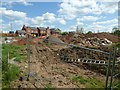
Work has now began on this development to the south of Drake Street in Welland.
Image: © Philip Halling
Taken: 16 May 2016
0.05 miles
3
Spring Meadows housing development
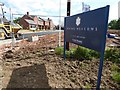
Spring Meadows housing development to the south of Drake Street in Welland.
Image: © Philip Halling
Taken: 16 May 2016
0.05 miles
4
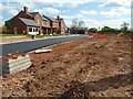
Spring Meadows housing development
Spring Meadows housing development at Welland.
Image: © Philip Halling
Taken: 16 May 2016
0.05 miles
5
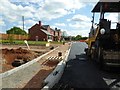
Spring Meadows development
Spring Meadows housing development at Welland.
Image: © Philip Halling
Taken: 16 May 2016
0.05 miles
7
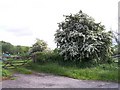
Hawthorn in May, Drake Street Welland
Any parts of the hawthorn that had not been trimmed last year are now pure white with blossom. The hill in the background may have hosted a windmill centuries ago if old maps of the area are to be believed.
Image: © Bob Embleton
Taken: 20 May 2006
0.08 miles
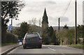
8
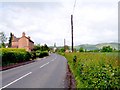
Drake Street, Welland
Looking west towards the spire of the Victorian St. James' Church on the crossroads at the modern heart of the village. The Malvern Hills provide a backdrop with Black Hill defaced by Berrington's Quarry and the twin peaked Pinnacle Hill on the right.
Image: © Bob Embleton
Taken: 20 May 2006
0.08 miles
9

Buttercups in Hay Meadow, Welland
Soon to be cut for Silage or left a while longer for hay. The Malvern hills are on the skyline with the twin peaked Pinnacle Hill boasting Bronze Age tumuli on the left and the Worcestershire Beacon to the right.
Image: © Bob Embleton
Taken: 20 May 2006
0.08 miles