IMAGES TAKEN NEAR TO
Mill Road, EVESHAM, WR11 8RF
Introduction
This page details the photographs taken nearby to Mill Road, WR11 8RF by members of the Geograph project.
The Geograph project started in 2005 with the aim of publishing, organising and preserving representative images for every square kilometre of Great Britain, Ireland and the Isle of Man.

There are currently over 7.5m images from over14,400 individuals and you can help contribute to the project by visiting https://www.geograph.org.uk
Image Map
Images are licensed for reuse under creativecommons.org/licenses/by-sa/2.0
Notes
- Clicking on the map will re-center to the selected point.
- The higher the marker number, the further away the image location is from the centre of the postcode.
Image Listing (10 Images Found)
Images are licensed for reuse under creativecommons.org/licenses/by-sa/2.0
Image
Details
Distance
6
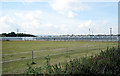
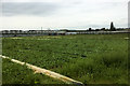
Glasshouses at Offenham
Glasshouses near the village of Offenham, a major centre for market gardening in the Vale of Evesham. Looking south-west with Bredon Hill in the distance.
Image: © Dave Bushell
Taken: 20 Sep 2005
0.18 miles
7
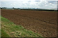
Glasshouses in Offenham
Being in the Vale of Evesham horticulture and market gardening is an important local industry.
Image: © Philip Halling
Taken: 8 Aug 2010
0.19 miles
10
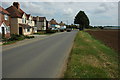
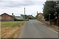
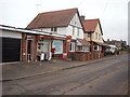
Laurel Road, Offenham
Houses on Laurel Road in Offenham.
Image: © Philip Halling
Taken: 8 Aug 2010
0.24 miles