
IMAGES TAKEN NEAR TO
Pershore Road, PERSHORE, WR10 3EW
Introduction
This page details the photographs taken nearby to Pershore Road, WR10 3EW by members of the Geograph project.
The Geograph project started in 2005 with the aim of publishing, organising and preserving representative images for every square kilometre of Great Britain, Ireland and the Isle of Man.

There are currently over 7.5m images from over14,400 individuals and you can help contribute to the project by visiting https://www.geograph.org.uk
Image Map
Images are licensed for reuse under creativecommons.org/licenses/by-sa/2.0
Notes
- Clicking on the map will re-center to the selected point.
- The higher the marker number, the further away the image location is from the centre of the postcode.
Image Listing (83 Images Found)
Images are licensed for reuse under creativecommons.org/licenses/by-sa/2.0
Image
Details
Distance
1
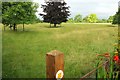
Sheep pasture, Little Comberton
Footpath LC 508 crosses this parkland landscape, starting from a narrow alley between houses on Pershore Road. Both path and central view are virtually along a northing grid line.
Image: © Derek Harper
Taken: 1 Jul 2017
0.04 miles
2
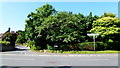
Little Comberton crossroads
Left to Elmley castle, right to Pershore and straight on to the church; Image
Image: © Jonathan Billinger
Taken: 25 Jun 2013
0.06 miles
3
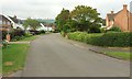
Wick Road, Little Comberton
Looking left from where Image] was taken.
Image: © Derek Harper
Taken: 1 Jul 2017
0.06 miles
4
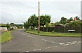
Orchard Drive, Little Comberton
The remnants of orchards are all around the village. The modern road leaves Wick Road here.
Image: © Derek Harper
Taken: 1 Jul 2017
0.06 miles
5
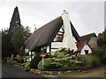
Meadow Cottage
Manor Lane contains a number of half timbered cottages. http://www.britishlistedbuildings.co.uk/en-443586-meadow-cottage-little-comberton-worceste
Image: © Jonathan Thacker
Taken: 9 Oct 2014
0.07 miles
6
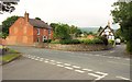
Junction, Little Comberton
A crossroads more or less at the centre of the village. Down Manor Lane is an end view of the timber-framed C17 cottages described at https://www.historicengland.org.uk/listing/the-list/list-entry/1242717 .
Image: © Derek Harper
Taken: 1 Jul 2017
0.07 miles
7

Sheep pasture, Little Comberton
Looking left from where Image] was taken.
Image: © Derek Harper
Taken: 1 Jul 2017
0.09 miles
8
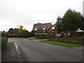
Little Comberton
While Manor Lane has a number of half-timbered cottages most of the village is twentieth century suburban.
Image: © Jonathan Thacker
Taken: 9 Oct 2014
0.09 miles
9
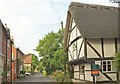
Cottages in Little Comberton
This is Manor Lane. On the right is Fern Dairy https://www.historicengland.org.uk/listing/the-list/list-entry/1242720 ; on the left, Stoneside https://www.historicengland.org.uk/listing/the-list/list-entry/1259846 and the C18 former post office https://www.historicengland.org.uk/listing/the-list/list-entry/1242716 . Further along can be seen the rose-clad wall of The Laurela shown in Image
Image: © Derek Harper
Taken: 1 Jul 2017
0.09 miles
10
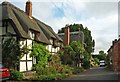
Cottages in Little Comberton
On Manor Lane, and all listed. On the left, the first of three C17 thatched cottages, is Wayside Cottage https://www.historicengland.org.uk/listing/the-list/list-entry/1242719 , followed by Fern Dairy https://www.historicengland.org.uk/listing/the-list/list-entry/1242720 , at right angles to the road. Further along is Meadow Cottage https://www.historicengland.org.uk/listing/the-list/list-entry/1259886 . On the right is the C18 brick former post office https://www.historicengland.org.uk/listing/the-list/list-entry/1242716 .
Image: © Derek Harper
Taken: 1 Jul 2017
0.10 miles