
IMAGES TAKEN NEAR TO
Hollands Road, PERSHORE, WR10 3DW
Introduction
This page details the photographs taken nearby to Hollands Road, WR10 3DW by members of the Geograph project.
The Geograph project started in 2005 with the aim of publishing, organising and preserving representative images for every square kilometre of Great Britain, Ireland and the Isle of Man.

There are currently over 7.5m images from over14,400 individuals and you can help contribute to the project by visiting https://www.geograph.org.uk
Image Map
Images are licensed for reuse under creativecommons.org/licenses/by-sa/2.0
Notes
- Clicking on the map will re-center to the selected point.
- The higher the marker number, the further away the image location is from the centre of the postcode.
Image Listing (17 Images Found)
Images are licensed for reuse under creativecommons.org/licenses/by-sa/2.0
Image
Details
Distance
1
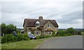
Semi-detached cottages on a bend near Woolas Hall
The OS map names each one as a cottage
Image: © David Smith
Taken: 16 Jun 2018
0.00 miles
2
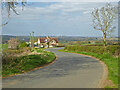
Westfield cottage near Great Comberton, Worcestershire
Image: © Chris Allen
Taken: 3 Apr 2021
0.01 miles
3
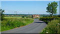
Lane and Westfield Cottage
Double bends in the road to Comberton.
A fine view over the Avon valley.
Image: © Jonathan Billinger
Taken: 25 Jun 2013
0.02 miles
4
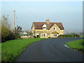
Road To Great Comberton, Cottage on Bend
Image: © Roy Hughes
Taken: 29 Nov 2014
0.02 miles
5
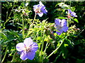
Geranium pratense, Meadow Cranesbill
Splashes of sky blue along the verges of this country lane.
Image: © Jonathan Billinger
Taken: 25 Jun 2013
0.06 miles
6
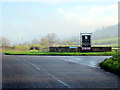
Entrance to Woollas Hall Near Great Comberton
Image: © Roy Hughes
Taken: 29 Nov 2014
0.16 miles
7
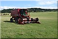
A Case 2366 combine harvester
The harvest is in and this Case 2366 combine harvester is parked up in a field near Woollas Hall Farm.
Image: © Philip Halling
Taken: 19 Aug 2018
0.17 miles
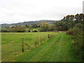
10
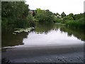
Nafford Weir
On the river Avon. With Weirs and Locks the river is navigable all year round.
Image: © Bob Embleton
Taken: 2 Jul 2005
0.18 miles