IMAGES TAKEN NEAR TO
Naunton Beauchamp, PERSHORE, WR10 2RF
Introduction
This page details the photographs taken nearby to WR10 2RF by members of the Geograph project.
The Geograph project started in 2005 with the aim of publishing, organising and preserving representative images for every square kilometre of Great Britain, Ireland and the Isle of Man.

There are currently over 7.5m images from over14,400 individuals and you can help contribute to the project by visiting https://www.geograph.org.uk
Image Map (Loading...)


Getting Data...Please wait
Leaflet Map data © OpenStreetMap
Images are licensed for reuse under creativecommons.org/licenses/by-sa/2.0
Notes
- Clicking on the map will re-center to the selected point.
- The higher the marker number, the further away the image location is from the centre of the postcode.
Image Listing (7 Images Found)
Images are licensed for reuse under creativecommons.org/licenses/by-sa/2.0
Image
Details
Distance
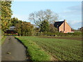
1
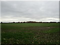
Autumn sown crop near Naunton Beauchamp
Looking towards The Field House.
Image: © Jonathan Thacker
Taken: 18 Nov 2021
0.09 miles
2
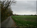
Roadway to Pincox Farm, Naunton Beauchamp
Image: © Jonathan Thacker
Taken: 18 Nov 2021
0.16 miles
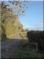
3
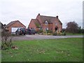
Pincox Farm
Between Naunton Beauchamp and Flyford Flavel
Image: © Bob Embleton
Taken: 27 Nov 2005
0.16 miles
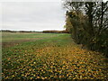
4
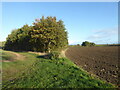
Fields near North Piddle
By Pincox Farm.
Image: © Chris Allen
Taken: 26 Oct 2020
0.17 miles
5
Pincox Farm, Worcestershire
Between North Piddle and Naunton Beauchamp. Seen from a public footpath that runs up the drive.
Image: © Chris Allen
Taken: 26 Oct 2020
0.17 miles
6
Drive to Pincox Farm
Between North Piddle and Naunton Beauchamp. It is also a public footpath
Image: © Chris Allen
Taken: 26 Oct 2020
0.19 miles
7
Grass field near Naunton Beauchamp
Image: © Jonathan Thacker
Taken: 18 Nov 2021
0.23 miles