
IMAGES TAKEN NEAR TO
The Cross, PERSHORE, WR10 2HP
Introduction
This page details the photographs taken nearby to The Cross, WR10 2HP by members of the Geograph project.
The Geograph project started in 2005 with the aim of publishing, organising and preserving representative images for every square kilometre of Great Britain, Ireland and the Isle of Man.

There are currently over 7.5m images from over14,400 individuals and you can help contribute to the project by visiting https://www.geograph.org.uk
Image Map
Images are licensed for reuse under creativecommons.org/licenses/by-sa/2.0
Notes
- Clicking on the map will re-center to the selected point.
- The higher the marker number, the further away the image location is from the centre of the postcode.
Image Listing (111 Images Found)
Images are licensed for reuse under creativecommons.org/licenses/by-sa/2.0
Image
Details
Distance
1
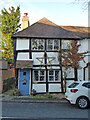
Cottage occupied by Attwood, Wyre Piddle
That is the wording of the entry on the British Listed Buildings website. I suspect it is now occupied by somebody of a different name. It is actually called Knights Cottage (no apostrophe). It is a 17th century timber framed building that is Listed Grade II.
Image: © Chris Allen
Taken: 4 Jan 2022
0.01 miles
2

Old Wayside Cross by the B4084, Worcester Road, Wyre Piddle
Wyre Cross, old shaft, base and steps in a new cross, by the B4084, in parish of Wyre Piddle (Wychavon District), Worcester Road junction with Church Street, in centre of road.
Grade II listed.
List Entry Number: 1273103 https://historicengland.org.uk/listing/the-list/list-entry/1273103
Scheduled Monument.
List Entry Number: 1015685 https://historicengland.org.uk/listing/the-list/list-entry/1015685
Surveyed
Milestone Society National ID: WOWA_WYR
Image: © Alan Rosevear
Taken: 6 Jun 2015
0.01 miles
3

Beech View Mr Boulter's Cottage, Wyre Piddle
That is the name on the British Listed Buildings website. The building itself now identifies itself as Staddle Stones. Listed Grade II for group value.
Image: © Chris Allen
Taken: 4 Jan 2022
0.01 miles
4

Main street in Wyre Piddle
The road is closed for roadworks, but this road has been closed to most traffic since the Wyre Piddle bypass was construction in the 1990s.
Image: © Philip Halling
Taken: 11 Aug 2023
0.01 miles
5
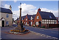
Village cross, Wyre Piddle
The name Wyre Piddle may cause an outbreak of schoolboy sniggering, but the Piddle part comes from the Piddle Brook which flows through the village on its way to the River Avon. Piddle is in fact an Old English word for marsh or fen. Wyre relates to Wyre Forest. In this view the village cross is a good example of a medieval standing cross still sited at its original location. The photograph was taken a few weeks before the village gained a by-pass although there isn't actually a vehicle in sight.
Image: © Stephen McKay
Taken: Unknown
0.01 miles
6
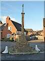
Village Cross, Wyre Piddle
Late mediaeval cross, Listed Grade II.
Image: © Chris Allen
Taken: 4 Jan 2022
0.01 miles
7
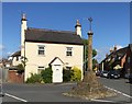
Old Toll House in Wyre Piddle
Toll House in Wyre Piddle by the former B4084, in parish of Wyre Piddle (Wychavon District), Turnpike Toll House (Cross Villa), in village centre.
Behind Wayside Cross: WOWA_WYR Image
Worcestershire and Worcester City HER.
HER Reference: WSM20431 https://www.heritagegateway.org.uk/Gateway/Results_Single.aspx?uid=MWR13663&resourceID=1035
To be surveyed
Milestone Society National ID: WO.WYR
Image: © Alan Rosevear
Taken: 6 Jun 2015
0.01 miles

9
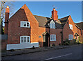
Miss Haines' Cottage the White Horse, Wyre Piddle
The above is the title as given on the website British Listed Buildings. It is 18th century with a brick front over a timber frame and Listed Grade II.
Image: © Chris Allen
Taken: 4 Jan 2022
0.02 miles
10

Houses on Main Road, Wyre Piddle, Worcestershire
Image: © Jeff Gogarty
Taken: 10 Aug 2021
0.02 miles