IMAGES TAKEN NEAR TO
Pendas Meadow, PERSHORE, WR10 2DQ
Introduction
This page details the photographs taken nearby to Pendas Meadow, WR10 2DQ by members of the Geograph project.
The Geograph project started in 2005 with the aim of publishing, organising and preserving representative images for every square kilometre of Great Britain, Ireland and the Isle of Man.

There are currently over 7.5m images from over14,400 individuals and you can help contribute to the project by visiting https://www.geograph.org.uk
Image Map (Loading...)


Getting Data...Please wait
Leaflet Map data © OpenStreetMap
Images are licensed for reuse under creativecommons.org/licenses/by-sa/2.0
Notes
- Clicking on the map will re-center to the selected point.
- The higher the marker number, the further away the image location is from the centre of the postcode.
Image Listing (18 Images Found)
Images are licensed for reuse under creativecommons.org/licenses/by-sa/2.0
Image
Details
Distance

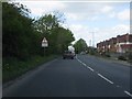
3
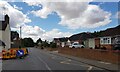
B4082 Pinvin towards the junction with A44
Image: © Jeff Gogarty
Taken: 5 Aug 2022
0.10 miles
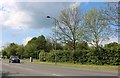
7
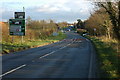
Crossroads at Pinvin
A staggered crossroads on the A44 at Pinvin.
Image: © Philip Halling
Taken: 23 Nov 2008
0.12 miles
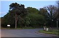
8

Beautiful sunset on Pinvin park
Can see the goal post - the only real feature at the park!
Image: © Tanya Burns
Taken: 2 Aug 2010
0.13 miles
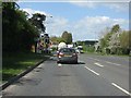
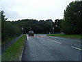
10
Junction on the A44, Pinvin
Turn right for Pershore Station, a few hundred yards along. Pinvin is on top of Pershore along and above the A44.
Image: © David Howard
Taken: 11 May 2019
0.15 miles